U13A Pakoon Wash, AZ, USA - Earthquake Result Viewer
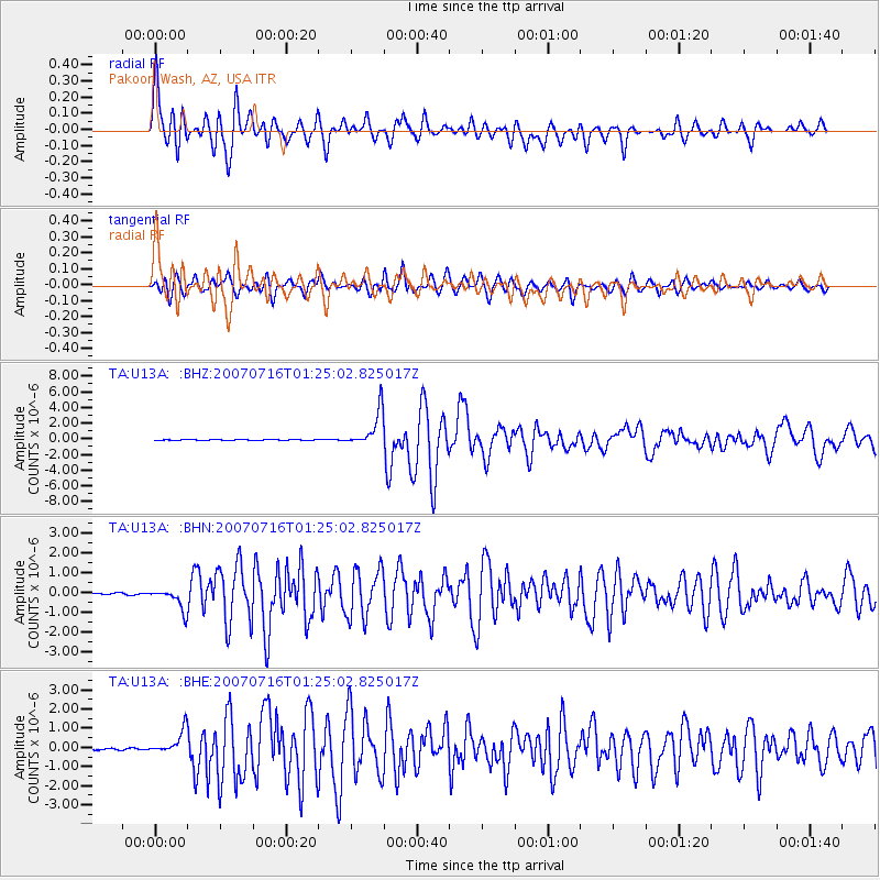
Earthquake location: Near West Coast Of Honshu, Japan
Earthquake latitude/longitude: 37.5/138.4
Earthquake time(UTC): 2007/07/16 (197) 01:13:22 GMT
Earthquake Depth: 12 km
Earthquake Magnitude: 6.5 MB, 6.4 MS, 6.6 MW, 6.5 MW
Earthquake Catalog/Contributor: WHDF/NEIC
Network: TA USArray Transportable Network (new EarthScope stations)
Station: U13A Pakoon Wash, AZ, USA
Lat/Lon: 36.42 N/113.97 W
Elevation: 712 m
Distance: 80.5 deg
Az: 51.223 deg
Baz: 309.799 deg
Ray Param: 0.048220623
Estimated Moho Depth: 17.5 km
Estimated Crust Vp/Vs: 2.02
Assumed Crust Vp: 6.194 km/s
Estimated Crust Vs: 3.07 km/s
Estimated Crust Poisson's Ratio: 0.34
Radial Match: 89.07265 %
Radial Bump: 400
Transverse Match: 89.91514 %
Transverse Bump: 400
SOD ConfigId: 2564
Insert Time: 2010-03-06 01:11:26.853 +0000
GWidth: 2.5
Max Bumps: 400
Tol: 0.001

Signal To Noise

ChannelStoNSTALTA
TA:U13A: :BHN:20070716T01:25:02.825017Z9.4612955.2557004E-75.5549485E-8
TA:U13A: :BHE:20070716T01:25:02.825017Z10.6377986.2052635E-75.833222E-8
TA:U13A: :BHZ:20070716T01:25:02.825017Z32.9445722.275978E-66.9085075E-8
Arrivals
Ps2.9 SECOND
PpPs8.3 SECOND
PsPs/PpSs11 SECOND