
U13A Pakoon Wash, AZ, USA - Earthquake Result Viewer
| ||||||||||||||||||
| ||||||||||||||||||
| ||||||||||||||||||
|
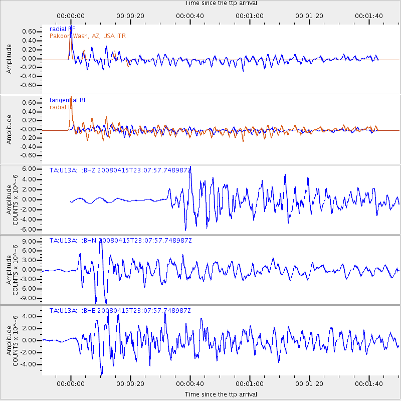
Signal To Noise
| Channel | StoN | STA | LTA |
| TA:U13A: :BHN:20080415T23:07:57.748987Z | 10.2549715 | 2.264956E-6 | 2.208642E-7 |
| TA:U13A: :BHE:20080415T23:07:57.748987Z | 2.4080453 | 8.021022E-7 | 3.3309266E-7 |
| TA:U13A: :BHZ:20080415T23:07:57.748987Z | 2.9855356 | 8.641297E-7 | 2.8943873E-7 |
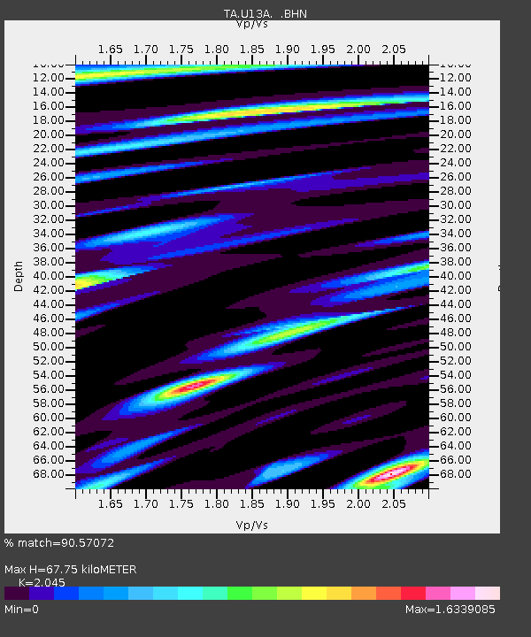
| Arrivals | |
| Ps | 12 SECOND |
| PpPs | 32 SECOND |
| PsPs/PpSs | 44 SECOND |

