You are here: Home > Network List > TA - USArray Transportable Network (new EarthScope stations) Stations List
> Station U13A Pakoon Wash, AZ, USA > Earthquake Result Viewer
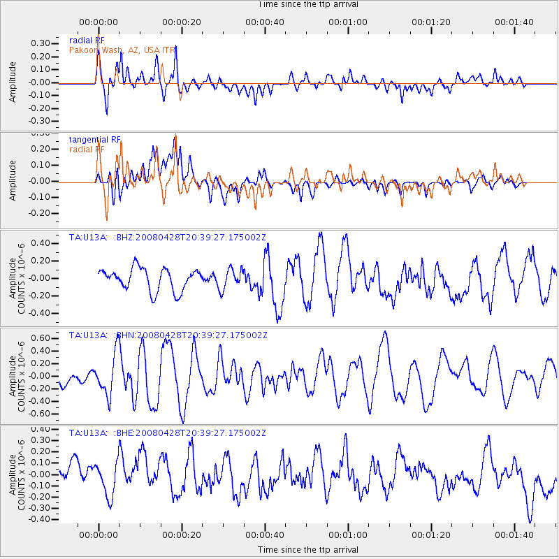
U13A Pakoon Wash, AZ, USA - Earthquake Result Viewer
*The percent match for this event was below the threshold and hence no stack was calculated.
| Earthquake location: |
Loyalty Islands |
| Earthquake latitude/longitude: |
-20.2/168.8 |
| Earthquake time(UTC): |
2008/04/28 (119) 20:26:53 GMT |
| Earthquake Depth: |
35 km |
| Earthquake Magnitude: |
5.8 MB, 5.7 MS, 6.1 MW, 6.0 MW |
| Earthquake Catalog/Contributor: |
WHDF/NEIC |
|
| Network: |
TA USArray Transportable Network (new EarthScope stations) |
| Station: |
U13A Pakoon Wash, AZ, USA |
| Lat/Lon: |
36.42 N/113.97 W |
| Elevation: |
712 m |
|
| Distance: |
92.0 deg |
| Az: |
51.917 deg |
| Baz: |
246.391 deg |
| Ray Param: |
$rayparam |
*The percent match for this event was below the threshold and hence was not used in the summary stack. |
|
| Radial Match: |
70.51551 % |
| Radial Bump: |
397 |
| Transverse Match: |
57.17791 % |
| Transverse Bump: |
400 |
| SOD ConfigId: |
2504 |
| Insert Time: |
2010-03-06 01:12:45.735 +0000 |
| GWidth: |
2.5 |
| Max Bumps: |
400 |
| Tol: |
0.001 |
|
Signal To Noise
| Channel | StoN | STA | LTA |
| TA:U13A: :BHN:20080428T20:39:27.175002Z | 4.9320083 | 3.404194E-7 | 6.902247E-8 |
| TA:U13A: :BHE:20080428T20:39:27.175002Z | 1.3557353 | 1.4784642E-7 | 1.0905257E-7 |
| TA:U13A: :BHZ:20080428T20:39:27.175002Z | 0.92846566 | 1.1669508E-7 | 1.2568594E-7 |
| Arrivals |
| Ps | |
| PpPs | |
| PsPs/PpSs | |


