You are here: Home > Network List > TA - USArray Transportable Network (new EarthScope stations) Stations List
> Station G23K Bananza Creek, AK, USA > Earthquake Result Viewer
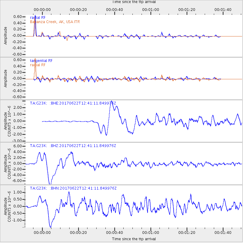
G23K Bananza Creek, AK, USA - Earthquake Result Viewer
*The percent match for this event was below the threshold and hence no stack was calculated.
| Earthquake location: |
Near Coast Of Guatemala |
| Earthquake latitude/longitude: |
13.7/-91.1 |
| Earthquake time(UTC): |
2017/06/22 (173) 12:31:04 GMT |
| Earthquake Depth: |
10 km |
| Earthquake Magnitude: |
6.8 Mi |
| Earthquake Catalog/Contributor: |
NEIC PDE/at |
|
| Network: |
TA USArray Transportable Network (new EarthScope stations) |
| Station: |
G23K Bananza Creek, AK, USA |
| Lat/Lon: |
66.71 N/150.02 W |
| Elevation: |
746 m |
|
| Distance: |
65.5 deg |
| Az: |
338.014 deg |
| Baz: |
113.777 deg |
| Ray Param: |
$rayparam |
*The percent match for this event was below the threshold and hence was not used in the summary stack. |
|
| Radial Match: |
97.24149 % |
| Radial Bump: |
255 |
| Transverse Match: |
89.47074 % |
| Transverse Bump: |
400 |
| SOD ConfigId: |
13570011 |
| Insert Time: |
2019-04-28 06:16:49.263 +0000 |
| GWidth: |
2.5 |
| Max Bumps: |
400 |
| Tol: |
0.001 |
|
Signal To Noise
| Channel | StoN | STA | LTA |
| TA:G23K: :BHZ:20170622T12:41:11.849976Z | 57.587635 | 3.9796237E-6 | 6.9105525E-8 |
| TA:G23K: :BHN:20170622T12:41:11.849976Z | 14.424361 | 7.104813E-7 | 4.9255647E-8 |
| TA:G23K: :BHE:20170622T12:41:11.849976Z | 41.2483 | 1.7456242E-6 | 4.231991E-8 |
| Arrivals |
| Ps | |
| PpPs | |
| PsPs/PpSs | |


