You are here: Home > Network List > UW - Pacific Northwest Regional Seismic Network Stations List
> Station MRBL Marblemount, WA, USA > Earthquake Result Viewer
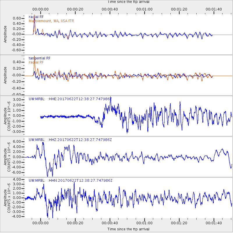
MRBL Marblemount, WA, USA - Earthquake Result Viewer
*The percent match for this event was below the threshold and hence no stack was calculated.
| Earthquake location: |
Near Coast Of Guatemala |
| Earthquake latitude/longitude: |
13.7/-91.1 |
| Earthquake time(UTC): |
2017/06/22 (173) 12:31:04 GMT |
| Earthquake Depth: |
10 km |
| Earthquake Magnitude: |
6.8 Mi |
| Earthquake Catalog/Contributor: |
NEIC PDE/at |
|
| Network: |
UW Pacific Northwest Regional Seismic Network |
| Station: |
MRBL Marblemount, WA, USA |
| Lat/Lon: |
48.52 N/121.48 W |
| Elevation: |
75 m |
|
| Distance: |
42.8 deg |
| Az: |
330.359 deg |
| Baz: |
133.701 deg |
| Ray Param: |
$rayparam |
*The percent match for this event was below the threshold and hence was not used in the summary stack. |
|
| Radial Match: |
84.00397 % |
| Radial Bump: |
400 |
| Transverse Match: |
69.44462 % |
| Transverse Bump: |
400 |
| SOD ConfigId: |
13570011 |
| Insert Time: |
2019-04-28 06:19:07.530 +0000 |
| GWidth: |
2.5 |
| Max Bumps: |
400 |
| Tol: |
0.001 |
|
Signal To Noise
| Channel | StoN | STA | LTA |
| UW:MRBL: :HHZ:20170622T12:38:27.747986Z | 44.471462 | 3.9059714E-6 | 8.783097E-8 |
| UW:MRBL: :HHN:20170622T12:38:27.747986Z | 13.036239 | 1.7612456E-6 | 1.3510382E-7 |
| UW:MRBL: :HHE:20170622T12:38:27.747986Z | 10.6060095 | 1.2046987E-6 | 1.1358643E-7 |
| Arrivals |
| Ps | |
| PpPs | |
| PsPs/PpSs | |


