You are here: Home > Network List > UW - Pacific Northwest Regional Seismic Network Stations List
> Station YACT Amboy, WA, USA > Earthquake Result Viewer
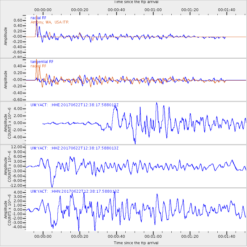
YACT Amboy, WA, USA - Earthquake Result Viewer
*The percent match for this event was below the threshold and hence no stack was calculated.
| Earthquake location: |
Near Coast Of Guatemala |
| Earthquake latitude/longitude: |
13.7/-91.1 |
| Earthquake time(UTC): |
2017/06/22 (173) 12:31:04 GMT |
| Earthquake Depth: |
10 km |
| Earthquake Magnitude: |
6.8 Mi |
| Earthquake Catalog/Contributor: |
NEIC PDE/at |
|
| Network: |
UW Pacific Northwest Regional Seismic Network |
| Station: |
YACT Amboy, WA, USA |
| Lat/Lon: |
45.93 N/122.42 W |
| Elevation: |
211 m |
|
| Distance: |
41.6 deg |
| Az: |
326.865 deg |
| Baz: |
130.428 deg |
| Ray Param: |
$rayparam |
*The percent match for this event was below the threshold and hence was not used in the summary stack. |
|
| Radial Match: |
84.758316 % |
| Radial Bump: |
400 |
| Transverse Match: |
62.998154 % |
| Transverse Bump: |
400 |
| SOD ConfigId: |
13570011 |
| Insert Time: |
2019-04-28 06:19:16.333 +0000 |
| GWidth: |
2.5 |
| Max Bumps: |
400 |
| Tol: |
0.001 |
|
Signal To Noise
| Channel | StoN | STA | LTA |
| UW:YACT: :HHZ:20170622T12:38:17.588013Z | 17.53448 | 4.7127774E-6 | 2.6877203E-7 |
| UW:YACT: :HHN:20170622T12:38:17.588013Z | 9.551261 | 1.659345E-6 | 1.7373047E-7 |
| UW:YACT: :HHE:20170622T12:38:17.588013Z | 8.232872 | 1.3822843E-6 | 1.6789818E-7 |
| Arrivals |
| Ps | |
| PpPs | |
| PsPs/PpSs | |


