You are here: Home > Network List > CI - Caltech Regional Seismic Network Stations List
> Station MPM Manuel Prospect Mine, California, USA > Earthquake Result Viewer
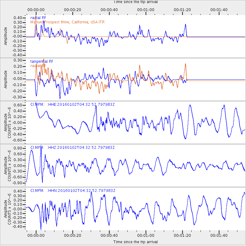
MPM Manuel Prospect Mine, California, USA - Earthquake Result Viewer
*The percent match for this event was below the threshold and hence no stack was calculated.
| Earthquake location: |
Northeastern China |
| Earthquake latitude/longitude: |
44.9/130.0 |
| Earthquake time(UTC): |
2016/01/02 (002) 04:22:19 GMT |
| Earthquake Depth: |
583 km |
| Earthquake Magnitude: |
5.7 MWP |
| Earthquake Catalog/Contributor: |
NEIC PDE/NEIC COMCAT |
|
| Network: |
CI Caltech Regional Seismic Network |
| Station: |
MPM Manuel Prospect Mine, California, USA |
| Lat/Lon: |
36.06 N/117.49 W |
| Elevation: |
185 m |
|
| Distance: |
79.0 deg |
| Az: |
49.68 deg |
| Baz: |
318.0 deg |
| Ray Param: |
$rayparam |
*The percent match for this event was below the threshold and hence was not used in the summary stack. |
|
| Radial Match: |
38.249218 % |
| Radial Bump: |
400 |
| Transverse Match: |
49.024746 % |
| Transverse Bump: |
400 |
| SOD ConfigId: |
1379111 |
| Insert Time: |
2016-01-16 04:50:27.177 +0000 |
| GWidth: |
2.5 |
| Max Bumps: |
400 |
| Tol: |
0.001 |
|
Signal To Noise
| Channel | StoN | STA | LTA |
| CI:MPM: :HHZ:20160102T04:32:52.797983Z | 1.1380858 | 4.3965994E-7 | 3.8631526E-7 |
| CI:MPM: :HHN:20160102T04:32:52.797983Z | 0.89909315 | 1.6115823E-7 | 1.792453E-7 |
| CI:MPM: :HHE:20160102T04:32:52.797983Z | 1.2271073 | 2.8715735E-7 | 2.3401161E-7 |
| Arrivals |
| Ps | |
| PpPs | |
| PsPs/PpSs | |


