
319A Douglas, AZ, USA - Earthquake Result Viewer
| ||||||||||||||||||
| ||||||||||||||||||
| ||||||||||||||||||
|
Signal To Noise
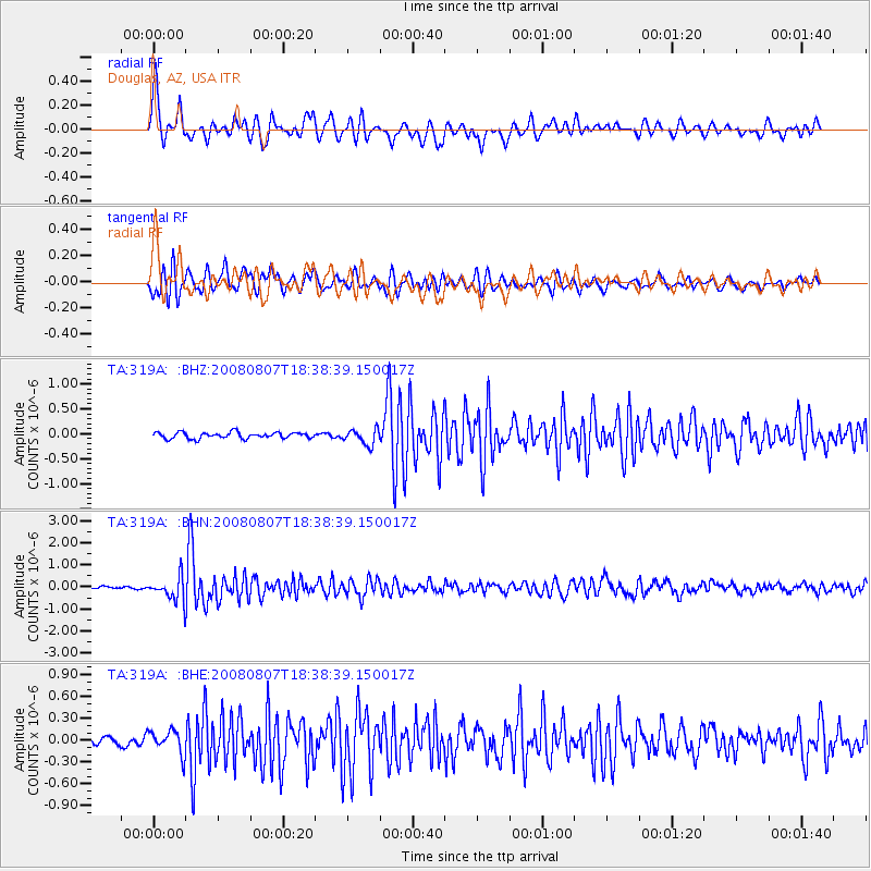
| Channel | StoN | STA | LTA |
| TA:319A: :BHN:20080807T18:38:39.150017Z | 9.423977 | 5.3058244E-7 | 5.6301335E-8 |
| TA:319A: :BHE:20080807T18:38:39.150017Z | 2.7992742 | 1.6202232E-7 | 5.7880115E-8 |
| TA:319A: :BHZ:20080807T18:38:39.150017Z | 2.5058522 | 1.550412E-7 | 6.187165E-8 |
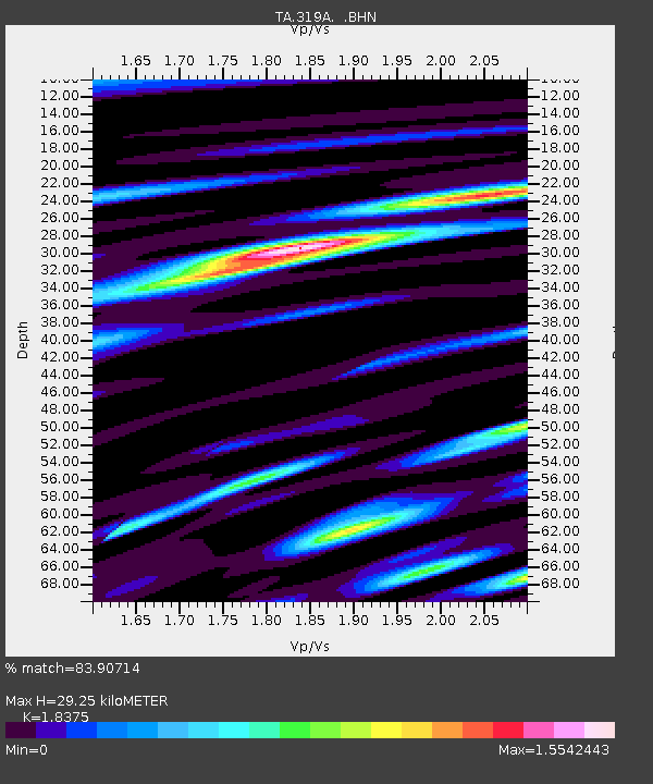
| Arrivals | |
| Ps | 4.2 SECOND |
| PpPs | 13 SECOND |
| PsPs/PpSs | 17 SECOND |

