319A Douglas, AZ, USA - Earthquake Result Viewer
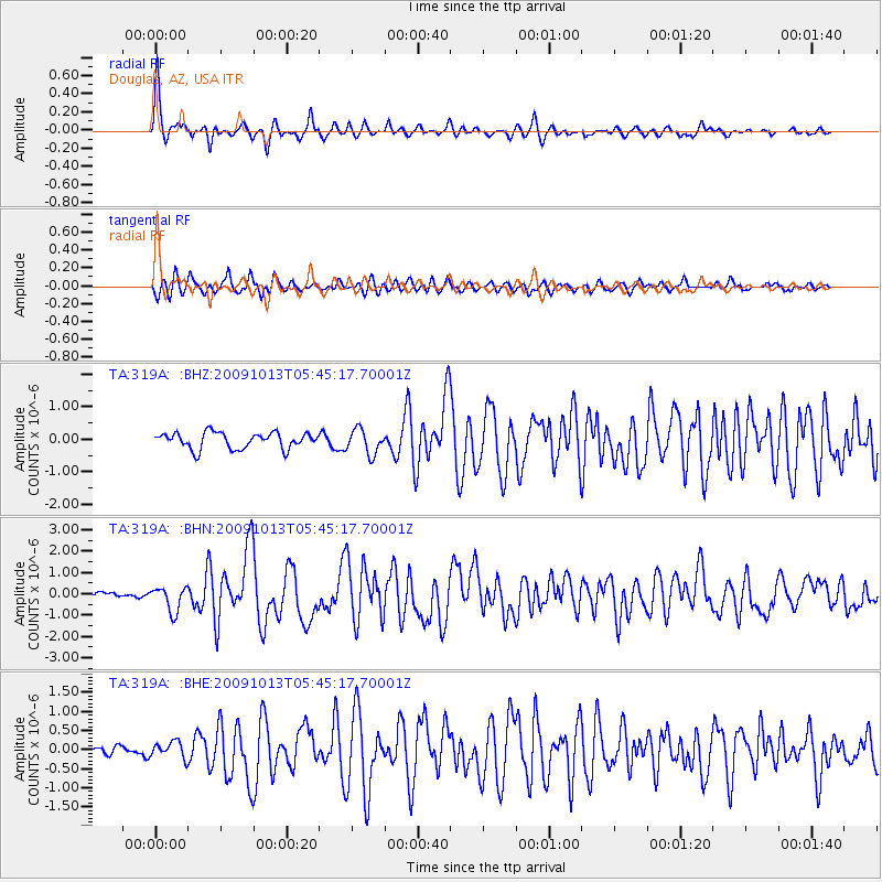
Earthquake location: Fox Islands, Aleutian Islands
Earthquake latitude/longitude: 52.8/-167.0
Earthquake time(UTC): 2009/10/13 (286) 05:37:23 GMT
Earthquake Depth: 24 km
Earthquake Magnitude: 6.0 MB, 6.1 MS, 6.5 MW, 6.5 MW
Earthquake Catalog/Contributor: WHDF/NEIC
Network: TA USArray Transportable Network (new EarthScope stations)
Station: 319A Douglas, AZ, USA
Lat/Lon: 31.38 N/109.28 W
Elevation: 1187 m
Distance: 46.4 deg
Az: 93.787 deg
Baz: 314.84 deg
Ray Param: 0.07060487
Estimated Moho Depth: 34.25 km
Estimated Crust Vp/Vs: 1.61
Assumed Crust Vp: 6.182 km/s
Estimated Crust Vs: 3.852 km/s
Estimated Crust Poisson's Ratio: 0.18
Radial Match: 91.5131 %
Radial Bump: 365
Transverse Match: 82.09362 %
Transverse Bump: 400
SOD ConfigId: 2622
Insert Time: 2010-03-06 01:14:58.040 +0000
GWidth: 2.5
Max Bumps: 400
Tol: 0.001

Signal To Noise

ChannelStoNSTALTA
TA:319A: :BHN:20091013T05:45:17.70001Z4.16900875.8155825E-71.3949557E-7
TA:319A: :BHE:20091013T05:45:17.70001Z1.81703582.160932E-71.1892622E-7
TA:319A: :BHZ:20091013T05:45:17.70001Z1.54002643.8049862E-72.470728E-7
Arrivals
Ps3.6 SECOND
PpPs14 SECOND
PsPs/PpSs17 SECOND