You are here: Home > Network List > TA - USArray Transportable Network (new EarthScope stations) Stations List
> Station 319A Douglas, AZ, USA > Earthquake Result Viewer
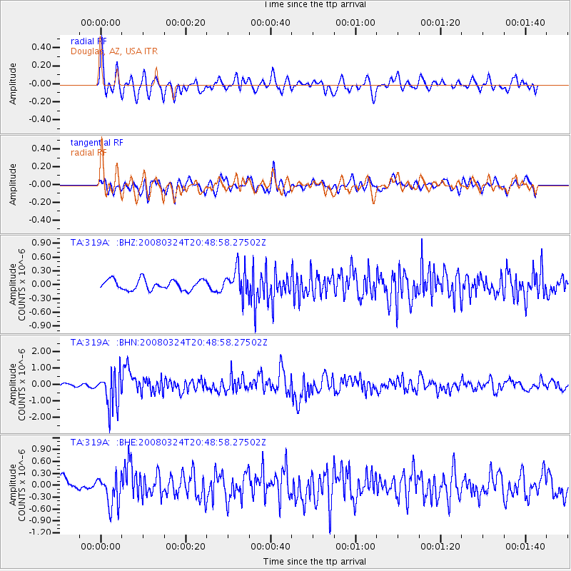
319A Douglas, AZ, USA - Earthquake Result Viewer
*The percent match for this event was below the threshold and hence no stack was calculated.
| Earthquake location: |
Chile-Bolivia Border Region |
| Earthquake latitude/longitude: |
-20.0/-69.0 |
| Earthquake time(UTC): |
2008/03/24 (084) 20:39:07 GMT |
| Earthquake Depth: |
120 km |
| Earthquake Magnitude: |
5.7 MB, 6.2 MW, 6.1 MW |
| Earthquake Catalog/Contributor: |
WHDF/NEIC |
|
| Network: |
TA USArray Transportable Network (new EarthScope stations) |
| Station: |
319A Douglas, AZ, USA |
| Lat/Lon: |
31.38 N/109.28 W |
| Elevation: |
1187 m |
|
| Distance: |
64.1 deg |
| Az: |
322.037 deg |
| Baz: |
137.455 deg |
| Ray Param: |
$rayparam |
*The percent match for this event was below the threshold and hence was not used in the summary stack. |
|
| Radial Match: |
69.67311 % |
| Radial Bump: |
400 |
| Transverse Match: |
72.609856 % |
| Transverse Bump: |
400 |
| SOD ConfigId: |
2504 |
| Insert Time: |
2010-03-06 01:17:06.489 +0000 |
| GWidth: |
2.5 |
| Max Bumps: |
400 |
| Tol: |
0.001 |
|
Signal To Noise
| Channel | StoN | STA | LTA |
| TA:319A: :BHN:20080324T20:48:58.27502Z | 5.6401496 | 1.0680146E-6 | 1.8935928E-7 |
| TA:319A: :BHE:20080324T20:48:58.27502Z | 2.3967085 | 3.9436725E-7 | 1.6454536E-7 |
| TA:319A: :BHZ:20080324T20:48:58.27502Z | 2.758201 | 3.037707E-7 | 1.10133634E-7 |
| Arrivals |
| Ps | |
| PpPs | |
| PsPs/PpSs | |


