You are here: Home > Network List > TA - USArray Transportable Network (new EarthScope stations) Stations List
> Station 319A Douglas, AZ, USA > Earthquake Result Viewer
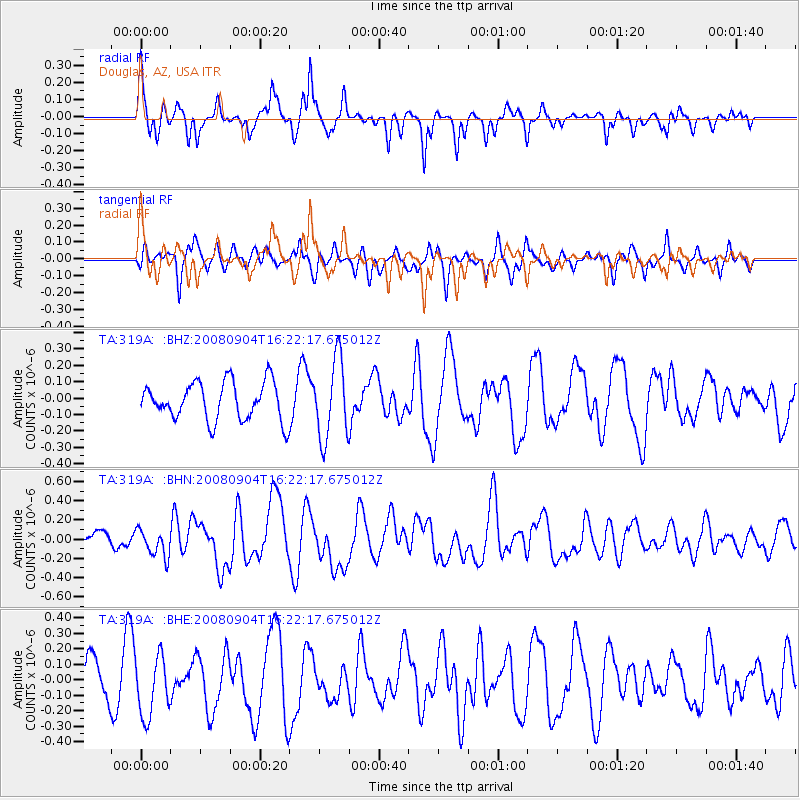
319A Douglas, AZ, USA - Earthquake Result Viewer
*The percent match for this event was below the threshold and hence no stack was calculated.
| Earthquake location: |
Kermadec Islands Region |
| Earthquake latitude/longitude: |
-31.6/-177.8 |
| Earthquake time(UTC): |
2008/09/04 (248) 16:09:51 GMT |
| Earthquake Depth: |
26 km |
| Earthquake Magnitude: |
5.5 MB, 5.9 MS, 5.8 MW, 5.7 MW |
| Earthquake Catalog/Contributor: |
WHDF/NEIC |
|
| Network: |
TA USArray Transportable Network (new EarthScope stations) |
| Station: |
319A Douglas, AZ, USA |
| Lat/Lon: |
31.38 N/109.28 W |
| Elevation: |
1187 m |
|
| Distance: |
90.1 deg |
| Az: |
52.745 deg |
| Baz: |
232.602 deg |
| Ray Param: |
$rayparam |
*The percent match for this event was below the threshold and hence was not used in the summary stack. |
|
| Radial Match: |
60.516144 % |
| Radial Bump: |
307 |
| Transverse Match: |
51.641605 % |
| Transverse Bump: |
321 |
| SOD ConfigId: |
2504 |
| Insert Time: |
2010-03-06 01:17:21.103 +0000 |
| GWidth: |
2.5 |
| Max Bumps: |
400 |
| Tol: |
0.001 |
|
Signal To Noise
| Channel | StoN | STA | LTA |
| TA:319A: :BHN:20080904T16:22:17.675012Z | 1.2205918 | 1.423351E-7 | 1.16611545E-7 |
| TA:319A: :BHE:20080904T16:22:17.675012Z | 1.9870402 | 1.9318998E-7 | 9.7225005E-8 |
| TA:319A: :BHZ:20080904T16:22:17.675012Z | 2.0890326 | 2.4190177E-7 | 1.1579607E-7 |
| Arrivals |
| Ps | |
| PpPs | |
| PsPs/PpSs | |


