You are here: Home > Network List > CN - Canadian National Seismograph Network Stations List
> Station INK INUVIK, NT > Earthquake Result Viewer
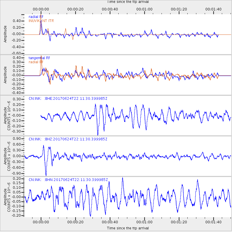
INK INUVIK, NT - Earthquake Result Viewer
*The percent match for this event was below the threshold and hence no stack was calculated.
| Earthquake location: |
Eastern Honshu, Japan |
| Earthquake latitude/longitude: |
35.8/137.6 |
| Earthquake time(UTC): |
2017/06/24 (175) 22:02:16 GMT |
| Earthquake Depth: |
10 km |
| Earthquake Magnitude: |
5.2 Mww |
| Earthquake Catalog/Contributor: |
NEIC PDE/us |
|
| Network: |
CN Canadian National Seismograph Network |
| Station: |
INK INUVIK, NT |
| Lat/Lon: |
68.31 N/133.53 W |
| Elevation: |
44 m |
|
| Distance: |
56.8 deg |
| Az: |
26.358 deg |
| Baz: |
283.936 deg |
| Ray Param: |
$rayparam |
*The percent match for this event was below the threshold and hence was not used in the summary stack. |
|
| Radial Match: |
77.92821 % |
| Radial Bump: |
400 |
| Transverse Match: |
70.70875 % |
| Transverse Bump: |
400 |
| SOD ConfigId: |
13570011 |
| Insert Time: |
2019-04-28 06:41:04.050 +0000 |
| GWidth: |
2.5 |
| Max Bumps: |
400 |
| Tol: |
0.001 |
|
Signal To Noise
| Channel | StoN | STA | LTA |
| CN:INK: :BHZ:20170624T22:11:30.399985Z | 8.132398 | 4.0572152E-7 | 4.9889536E-8 |
| CN:INK: :BHN:20170624T22:11:30.399985Z | 0.75005037 | 5.1469858E-8 | 6.862187E-8 |
| CN:INK: :BHE:20170624T22:11:30.399985Z | 3.1735997 | 1.5363696E-7 | 4.8410946E-8 |
| Arrivals |
| Ps | |
| PpPs | |
| PsPs/PpSs | |


