You are here: Home > Network List > CI - Caltech Regional Seismic Network Stations List
> Station ARV Arvin, Arvin, CA, USA > Earthquake Result Viewer
ARV Arvin, Arvin, CA, USA - Earthquake Result Viewer

| Earthquake location: |
Near Coast Of Nicaragua |
| Earthquake latitude/longitude: |
11.4/-86.7 |
| Earthquake time(UTC): |
2004/10/09 (283) 21:26:53 GMT |
| Earthquake Depth: |
35 km |
| Earthquake Magnitude: |
6.0 MB, 7.0 MS, 6.9 MW, 6.8 MW |
| Earthquake Catalog/Contributor: |
WHDF/NEIC |
|
| Network: |
CI Caltech Regional Seismic Network |
| Station: |
ARV Arvin, Arvin, CA, USA |
| Lat/Lon: |
35.13 N/118.83 W |
| Elevation: |
258 m |
|
| Distance: |
37.5 deg |
| Az: |
314.249 deg |
| Baz: |
121.041 deg |
| Ray Param: |
0.076016866 |
| Estimated Moho Depth: |
15.25 km |
| Estimated Crust Vp/Vs: |
2.10 |
| Assumed Crust Vp: |
6.1 km/s |
| Estimated Crust Vs: |
2.908 km/s |
| Estimated Crust Poisson's Ratio: |
0.35 |
|
| Radial Match: |
86.04233 % |
| Radial Bump: |
400 |
| Transverse Match: |
72.724625 % |
| Transverse Bump: |
400 |
| SOD ConfigId: |
2459 |
| Insert Time: |
2010-02-26 01:17:24.394 +0000 |
| GWidth: |
2.5 |
| Max Bumps: |
400 |
| Tol: |
0.001 |
|
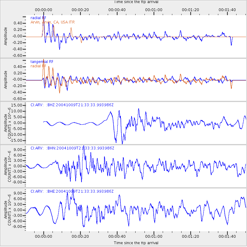
Signal To Noise
| Channel | StoN | STA | LTA |
| CI:ARV: :BHN:20041009T21:33:33.993986Z | 1.2185451 | 8.1962577E-7 | 6.726265E-7 |
| CI:ARV: :BHE:20041009T21:33:33.993986Z | 1.6906902 | 1.8723125E-6 | 1.107425E-6 |
| CI:ARV: :BHZ:20041009T21:33:33.993986Z | 2.1950006 | 2.0141902E-6 | 9.176262E-7 |
| Arrivals |
| Ps | 2.9 SECOND |
| PpPs | 7.3 SECOND |
| PsPs/PpSs | 10 SECOND |


