You are here: Home > Network List > IW - Intermountain West Stations List
> Station MOOW Moose Ponds, Wyoming, USA > Earthquake Result Viewer
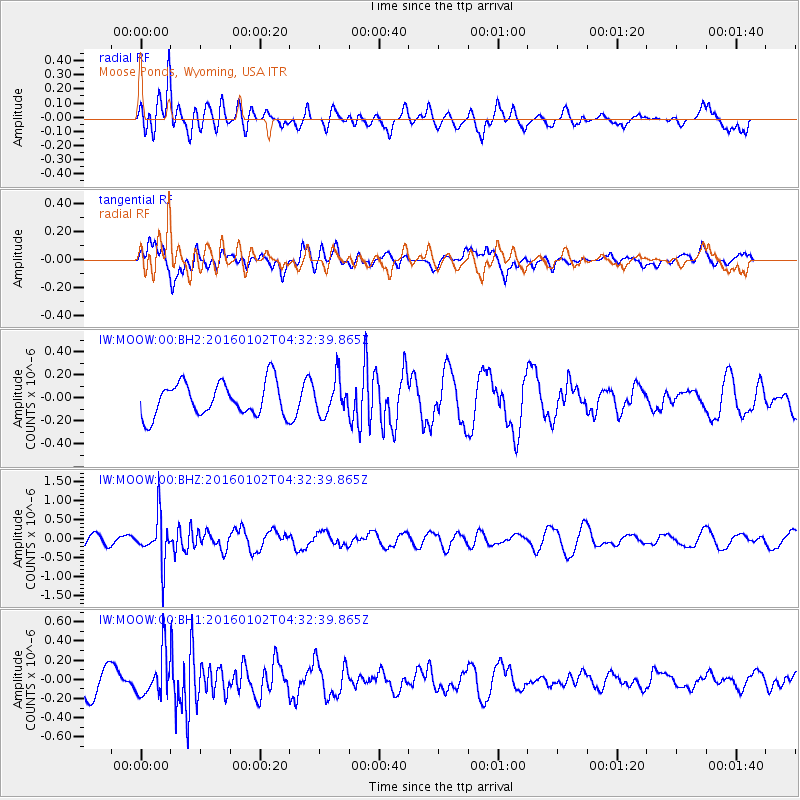
MOOW Moose Ponds, Wyoming, USA - Earthquake Result Viewer
*The percent match for this event was below the threshold and hence no stack was calculated.
| Earthquake location: |
Northeastern China |
| Earthquake latitude/longitude: |
44.9/130.0 |
| Earthquake time(UTC): |
2016/01/02 (002) 04:22:19 GMT |
| Earthquake Depth: |
583 km |
| Earthquake Magnitude: |
5.7 MWP |
| Earthquake Catalog/Contributor: |
NEIC PDE/NEIC COMCAT |
|
| Network: |
IW Intermountain West |
| Station: |
MOOW Moose Ponds, Wyoming, USA |
| Lat/Lon: |
43.75 N/110.74 W |
| Elevation: |
2128 m |
|
| Distance: |
76.6 deg |
| Az: |
40.531 deg |
| Baz: |
320.38 deg |
| Ray Param: |
$rayparam |
*The percent match for this event was below the threshold and hence was not used in the summary stack. |
|
| Radial Match: |
62.962498 % |
| Radial Bump: |
400 |
| Transverse Match: |
56.917263 % |
| Transverse Bump: |
400 |
| SOD ConfigId: |
1379111 |
| Insert Time: |
2016-01-16 05:07:34.220 +0000 |
| GWidth: |
2.5 |
| Max Bumps: |
400 |
| Tol: |
0.001 |
|
Signal To Noise
| Channel | StoN | STA | LTA |
| IW:MOOW:00:BHZ:20160102T04:32:39.865Z | 3.1123514 | 5.8368107E-7 | 1.8753701E-7 |
| IW:MOOW:00:BH1:20160102T04:32:39.865Z | 1.8203189 | 2.2589204E-7 | 1.2409477E-7 |
| IW:MOOW:00:BH2:20160102T04:32:39.865Z | 1.0570174 | 1.5403604E-7 | 1.4572707E-7 |
| Arrivals |
| Ps | |
| PpPs | |
| PsPs/PpSs | |


