116A Eloy, AZ, USA - Earthquake Result Viewer
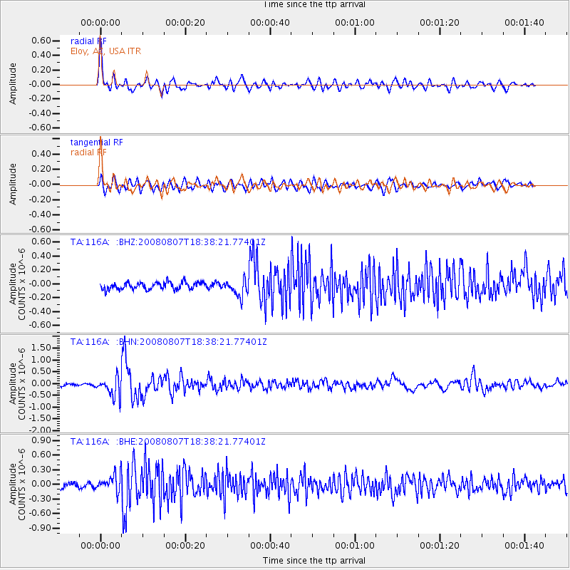
Earthquake location: Andreanof Islands, Aleutian Is.
Earthquake latitude/longitude: 52.2/-175.7
Earthquake time(UTC): 2008/08/07 (220) 18:30:03 GMT
Earthquake Depth: 12 km
Earthquake Magnitude: 5.6 MB, 5.5 MS, 5.8 MW, 5.8 MW
Earthquake Catalog/Contributor: WHDF/NEIC
Network: TA USArray Transportable Network (new EarthScope stations)
Station: 116A Eloy, AZ, USA
Lat/Lon: 32.56 N/111.70 W
Elevation: 477 m
Distance: 49.4 deg
Az: 87.172 deg
Baz: 313.27 deg
Ray Param: 0.06870321
Estimated Moho Depth: 28.0 km
Estimated Crust Vp/Vs: 1.69
Assumed Crust Vp: 6.276 km/s
Estimated Crust Vs: 3.725 km/s
Estimated Crust Poisson's Ratio: 0.23
Radial Match: 83.291405 %
Radial Bump: 400
Transverse Match: 67.48122 %
Transverse Bump: 400
SOD ConfigId: 2504
Insert Time: 2010-03-06 01:18:58.831 +0000
GWidth: 2.5
Max Bumps: 400
Tol: 0.001

Signal To Noise

ChannelStoNSTALTA
TA:116A: :BHN:20080807T18:38:21.77401Z8.6577474.0981476E-74.7335035E-8
TA:116A: :BHE:20080807T18:38:21.77401Z3.19852231.7760092E-75.5525927E-8
TA:116A: :BHZ:20080807T18:38:21.77401Z2.36845041.2186018E-75.1451444E-8
Arrivals
Ps3.2 SECOND
PpPs11 SECOND
PsPs/PpSs15 SECOND