You are here: Home > Network List > UW - Pacific Northwest Regional Seismic Network Stations List
> Station LEBA Lebam, WA, USA > Earthquake Result Viewer
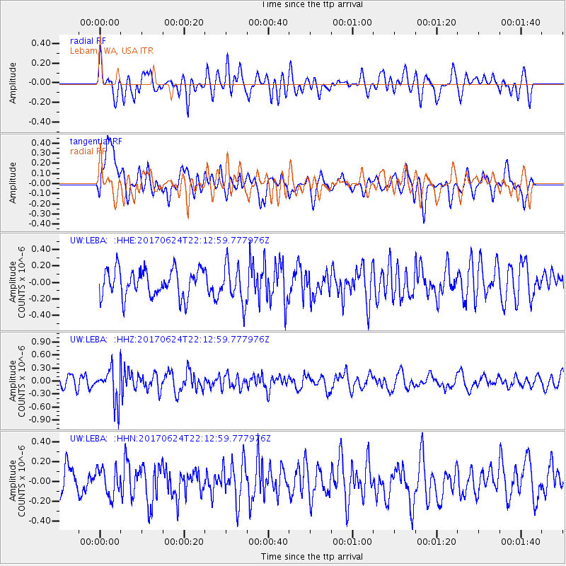
LEBA Lebam, WA, USA - Earthquake Result Viewer
*The percent match for this event was below the threshold and hence no stack was calculated.
| Earthquake location: |
Eastern Honshu, Japan |
| Earthquake latitude/longitude: |
35.8/137.6 |
| Earthquake time(UTC): |
2017/06/24 (175) 22:02:16 GMT |
| Earthquake Depth: |
10 km |
| Earthquake Magnitude: |
5.2 Mww |
| Earthquake Catalog/Contributor: |
NEIC PDE/us |
|
| Network: |
UW Pacific Northwest Regional Seismic Network |
| Station: |
LEBA Lebam, WA, USA |
| Lat/Lon: |
46.55 N/123.56 W |
| Elevation: |
73 m |
|
| Distance: |
70.4 deg |
| Az: |
46.386 deg |
| Baz: |
301.51 deg |
| Ray Param: |
$rayparam |
*The percent match for this event was below the threshold and hence was not used in the summary stack. |
|
| Radial Match: |
60.70346 % |
| Radial Bump: |
400 |
| Transverse Match: |
51.628616 % |
| Transverse Bump: |
400 |
| SOD ConfigId: |
13570011 |
| Insert Time: |
2019-04-28 06:48:22.977 +0000 |
| GWidth: |
2.5 |
| Max Bumps: |
400 |
| Tol: |
0.001 |
|
Signal To Noise
| Channel | StoN | STA | LTA |
| UW:LEBA: :HHZ:20170624T22:12:59.777976Z | 3.5816545 | 4.0298232E-7 | 1.125129E-7 |
| UW:LEBA: :HHN:20170624T22:12:59.777976Z | 1.2308486 | 1.3903848E-7 | 1.1296149E-7 |
| UW:LEBA: :HHE:20170624T22:12:59.777976Z | 1.4009852 | 2.2974919E-7 | 1.6399116E-7 |
| Arrivals |
| Ps | |
| PpPs | |
| PsPs/PpSs | |


