116A Eloy, AZ, USA - Earthquake Result Viewer
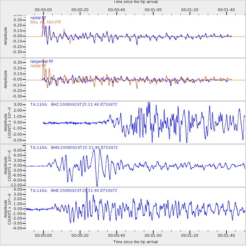
Earthquake location: Kermadec Islands, New Zealand
Earthquake latitude/longitude: -29.8/-177.7
Earthquake time(UTC): 2008/09/29 (273) 15:19:31 GMT
Earthquake Depth: 36 km
Earthquake Magnitude: 6.5 MB, 6.7 MS, 7.0 MW, 7.0 MW
Earthquake Catalog/Contributor: WHDF/NEIC
Network: TA USArray Transportable Network (new EarthScope stations)
Station: 116A Eloy, AZ, USA
Lat/Lon: 32.56 N/111.70 W
Elevation: 477 m
Distance: 88.0 deg
Az: 50.513 deg
Baz: 232.631 deg
Ray Param: 0.042842727
Estimated Moho Depth: 64.75 km
Estimated Crust Vp/Vs: 1.86
Assumed Crust Vp: 6.276 km/s
Estimated Crust Vs: 3.37 km/s
Estimated Crust Poisson's Ratio: 0.30
Radial Match: 96.28626 %
Radial Bump: 400
Transverse Match: 94.42911 %
Transverse Bump: 400
SOD ConfigId: 2560
Insert Time: 2010-03-06 01:19:07.920 +0000
GWidth: 2.5
Max Bumps: 400
Tol: 0.001

Signal To Noise

ChannelStoNSTALTA
TA:116A: :BHN:20080929T15:31:46.873997Z10.7435146.965756E-76.4836854E-8
TA:116A: :BHE:20080929T15:31:46.873997Z1.62244551.4439205E-78.899654E-8
TA:116A: :BHZ:20080929T15:31:46.873997Z2.63775321.6608224E-76.296352E-8
Arrivals
Ps9.1 SECOND
PpPs29 SECOND
PsPs/PpSs38 SECOND