You are here: Home > Network List > UW - Pacific Northwest Regional Seismic Network Stations List
> Station MRBL Marblemount, WA, USA > Earthquake Result Viewer
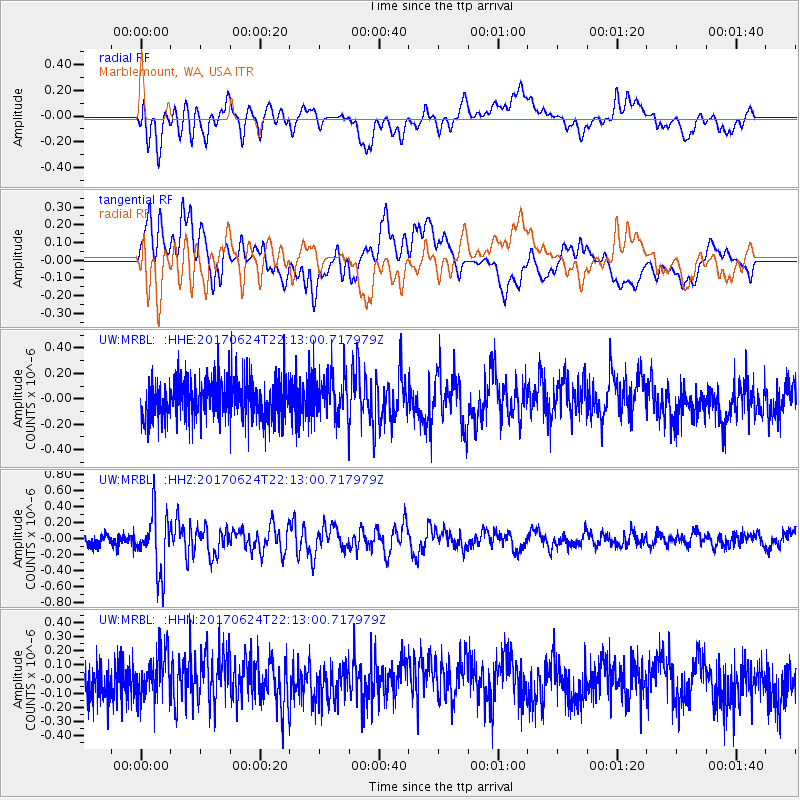
MRBL Marblemount, WA, USA - Earthquake Result Viewer
*The percent match for this event was below the threshold and hence no stack was calculated.
| Earthquake location: |
Eastern Honshu, Japan |
| Earthquake latitude/longitude: |
35.8/137.6 |
| Earthquake time(UTC): |
2017/06/24 (175) 22:02:16 GMT |
| Earthquake Depth: |
10 km |
| Earthquake Magnitude: |
5.2 Mww |
| Earthquake Catalog/Contributor: |
NEIC PDE/us |
|
| Network: |
UW Pacific Northwest Regional Seismic Network |
| Station: |
MRBL Marblemount, WA, USA |
| Lat/Lon: |
48.52 N/121.48 W |
| Elevation: |
75 m |
|
| Distance: |
70.6 deg |
| Az: |
43.819 deg |
| Baz: |
302.181 deg |
| Ray Param: |
$rayparam |
*The percent match for this event was below the threshold and hence was not used in the summary stack. |
|
| Radial Match: |
68.47991 % |
| Radial Bump: |
400 |
| Transverse Match: |
58.644173 % |
| Transverse Bump: |
400 |
| SOD ConfigId: |
13570011 |
| Insert Time: |
2019-04-28 06:48:26.380 +0000 |
| GWidth: |
2.5 |
| Max Bumps: |
400 |
| Tol: |
0.001 |
|
Signal To Noise
| Channel | StoN | STA | LTA |
| UW:MRBL: :HHZ:20170624T22:13:00.717979Z | 4.53997 | 3.6622686E-7 | 8.066724E-8 |
| UW:MRBL: :HHN:20170624T22:13:00.717979Z | 1.3054763 | 1.6802584E-7 | 1.2870846E-7 |
| UW:MRBL: :HHE:20170624T22:13:00.717979Z | 1.093032 | 1.7034777E-7 | 1.5584885E-7 |
| Arrivals |
| Ps | |
| PpPs | |
| PsPs/PpSs | |


