
116A Eloy, AZ, USA - Earthquake Result Viewer
| ||||||||||||||||||
| ||||||||||||||||||
| ||||||||||||||||||
|

Signal To Noise
| Channel | StoN | STA | LTA |
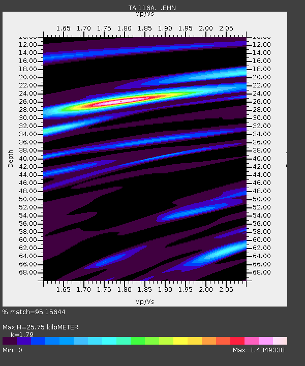
| TA:116A: :BHN:20071219T09:39:02.299001Z | 2.7466347 | 7.775737E-7 | 2.831005E-7 |
| TA:116A: :BHE:20071219T09:39:02.299001Z | 3.7352586 | 9.398024E-7 | 2.5160304E-7 |
| TA:116A: :BHZ:20071219T09:39:02.299001Z | 9.622125 | 2.2820575E-6 | 2.3716774E-7 |
| Arrivals | |
| Ps | 3.4 SECOND |
| PpPs | 11 SECOND |
| PsPs/PpSs | 14 SECOND |

