116A Eloy, AZ, USA - Earthquake Result Viewer
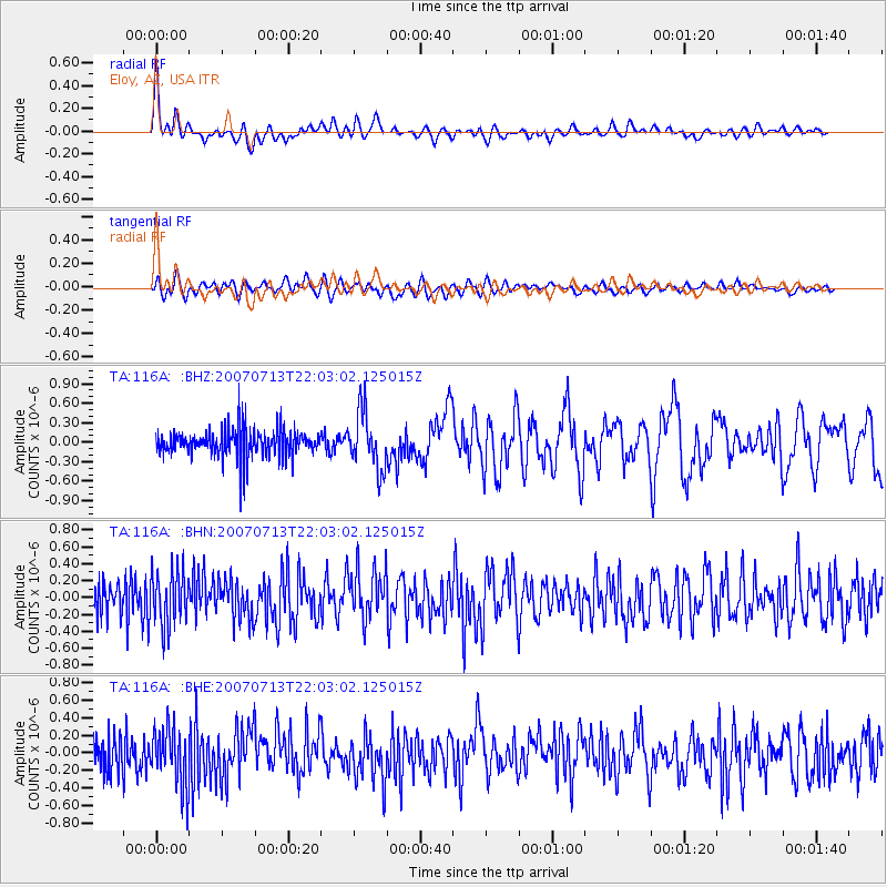
Earthquake location: Andreanof Islands, Aleutian Is.
Earthquake latitude/longitude: 51.8/-176.3
Earthquake time(UTC): 2007/07/13 (194) 21:54:43 GMT
Earthquake Depth: 35 km
Earthquake Magnitude: 5.7 MB, 5.6 MS, 6.0 MW, 5.9 MW
Earthquake Catalog/Contributor: WHDF/NEIC
Network: TA USArray Transportable Network (new EarthScope stations)
Station: 116A Eloy, AZ, USA
Lat/Lon: 32.56 N/111.70 W
Elevation: 477 m
Distance: 49.8 deg
Az: 86.397 deg
Baz: 312.837 deg
Ray Param: 0.06838109
Estimated Moho Depth: 21.25 km
Estimated Crust Vp/Vs: 1.86
Assumed Crust Vp: 6.276 km/s
Estimated Crust Vs: 3.383 km/s
Estimated Crust Poisson's Ratio: 0.30
Radial Match: 85.73653 %
Radial Bump: 400
Transverse Match: 64.564354 %
Transverse Bump: 400
SOD ConfigId: 2564
Insert Time: 2010-03-06 01:20:09.013 +0000
GWidth: 2.5
Max Bumps: 400
Tol: 0.001

Signal To Noise

ChannelStoNSTALTA
TA:116A: :BHN:20070713T22:03:02.125015Z0.863244243.1903863E-73.6958096E-7
TA:116A: :BHE:20070713T22:03:02.125015Z0.678499163.2869806E-74.844487E-7
TA:116A: :BHZ:20070713T22:03:02.125015Z2.0832824.4129558E-72.118271E-7
Arrivals
Ps3.1 SECOND
PpPs9.2 SECOND
PsPs/PpSs12 SECOND