You are here: Home > Network List > CI - Caltech Regional Seismic Network Stations List
> Station MPM Manuel Prospect Mine, California, USA > Earthquake Result Viewer
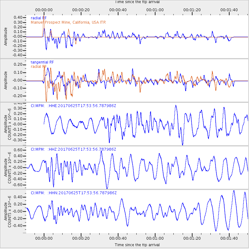
MPM Manuel Prospect Mine, California, USA - Earthquake Result Viewer
*The percent match for this event was below the threshold and hence no stack was calculated.
| Earthquake location: |
Fiji Islands Region |
| Earthquake latitude/longitude: |
-19.7/-176.5 |
| Earthquake time(UTC): |
2017/06/25 (176) 17:42:30 GMT |
| Earthquake Depth: |
38 km |
| Earthquake Magnitude: |
6.2 Mww |
| Earthquake Catalog/Contributor: |
NEIC PDE/us |
|
| Network: |
CI Caltech Regional Seismic Network |
| Station: |
MPM Manuel Prospect Mine, California, USA |
| Lat/Lon: |
36.06 N/117.49 W |
| Elevation: |
185 m |
|
| Distance: |
78.6 deg |
| Az: |
45.099 deg |
| Baz: |
235.466 deg |
| Ray Param: |
$rayparam |
*The percent match for this event was below the threshold and hence was not used in the summary stack. |
|
| Radial Match: |
61.205944 % |
| Radial Bump: |
400 |
| Transverse Match: |
74.493866 % |
| Transverse Bump: |
304 |
| SOD ConfigId: |
13570011 |
| Insert Time: |
2019-04-28 06:51:48.982 +0000 |
| GWidth: |
2.5 |
| Max Bumps: |
400 |
| Tol: |
0.001 |
|
Signal To Noise
| Channel | StoN | STA | LTA |
| CI:MPM: :HHZ:20170625T17:53:56.787986Z | 2.3010411 | 2.3574631E-7 | 1.0245202E-7 |
| CI:MPM: :HHN:20170625T17:53:56.787986Z | 1.4547424 | 1.7129362E-7 | 1.1774842E-7 |
| CI:MPM: :HHE:20170625T17:53:56.787986Z | 0.8066869 | 7.917706E-8 | 9.815092E-8 |
| Arrivals |
| Ps | |
| PpPs | |
| PsPs/PpSs | |


