You are here: Home > Network List > TA - USArray Transportable Network (new EarthScope stations) Stations List
> Station J20K Nowitna River, AK, USA > Earthquake Result Viewer
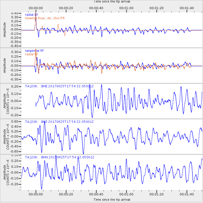
J20K Nowitna River, AK, USA - Earthquake Result Viewer
*The percent match for this event was below the threshold and hence no stack was calculated.
| Earthquake location: |
Fiji Islands Region |
| Earthquake latitude/longitude: |
-19.7/-176.5 |
| Earthquake time(UTC): |
2017/06/25 (176) 17:42:30 GMT |
| Earthquake Depth: |
38 km |
| Earthquake Magnitude: |
6.2 Mww |
| Earthquake Catalog/Contributor: |
NEIC PDE/us |
|
| Network: |
TA USArray Transportable Network (new EarthScope stations) |
| Station: |
J20K Nowitna River, AK, USA |
| Lat/Lon: |
64.18 N/154.15 W |
| Elevation: |
314 m |
|
| Distance: |
85.3 deg |
| Az: |
9.605 deg |
| Baz: |
201.04 deg |
| Ray Param: |
$rayparam |
*The percent match for this event was below the threshold and hence was not used in the summary stack. |
|
| Radial Match: |
73.10521 % |
| Radial Bump: |
400 |
| Transverse Match: |
63.33104 % |
| Transverse Bump: |
381 |
| SOD ConfigId: |
13570011 |
| Insert Time: |
2019-04-28 06:55:10.103 +0000 |
| GWidth: |
2.5 |
| Max Bumps: |
400 |
| Tol: |
0.001 |
|
Signal To Noise
| Channel | StoN | STA | LTA |
| TA:J20K: :BHZ:20170625T17:54:32.05001Z | 3.6562445 | 2.9912275E-7 | 8.1811464E-8 |
| TA:J20K: :BHN:20170625T17:54:32.05001Z | 1.863564 | 1.3504716E-7 | 7.246714E-8 |
| TA:J20K: :BHE:20170625T17:54:32.05001Z | 1.260403 | 7.112614E-8 | 5.643126E-8 |
| Arrivals |
| Ps | |
| PpPs | |
| PsPs/PpSs | |


