You are here: Home > Network List > TA - USArray Transportable Network (new EarthScope stations) Stations List
> Station O17K Koliganek, Bristol Bay, AK, USA > Earthquake Result Viewer
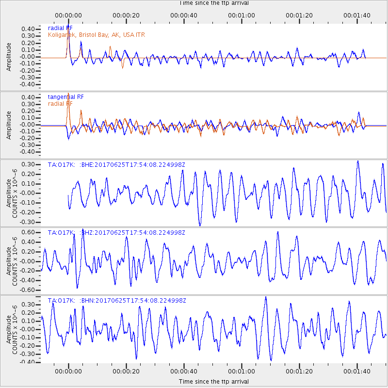
O17K Koliganek, Bristol Bay, AK, USA - Earthquake Result Viewer
*The percent match for this event was below the threshold and hence no stack was calculated.
| Earthquake location: |
Fiji Islands Region |
| Earthquake latitude/longitude: |
-19.7/-176.5 |
| Earthquake time(UTC): |
2017/06/25 (176) 17:42:30 GMT |
| Earthquake Depth: |
38 km |
| Earthquake Magnitude: |
6.2 Mww |
| Earthquake Catalog/Contributor: |
NEIC PDE/us |
|
| Network: |
TA USArray Transportable Network (new EarthScope stations) |
| Station: |
O17K Koliganek, Bristol Bay, AK, USA |
| Lat/Lon: |
59.77 N/157.09 W |
| Elevation: |
156 m |
|
| Distance: |
80.7 deg |
| Az: |
9.789 deg |
| Baz: |
198.462 deg |
| Ray Param: |
$rayparam |
*The percent match for this event was below the threshold and hence was not used in the summary stack. |
|
| Radial Match: |
73.71392 % |
| Radial Bump: |
400 |
| Transverse Match: |
47.930824 % |
| Transverse Bump: |
400 |
| SOD ConfigId: |
13570011 |
| Insert Time: |
2019-04-28 06:55:37.879 +0000 |
| GWidth: |
2.5 |
| Max Bumps: |
400 |
| Tol: |
0.001 |
|
Signal To Noise
| Channel | StoN | STA | LTA |
| TA:O17K: :BHZ:20170625T17:54:08.224998Z | 2.72587 | 3.2182277E-7 | 1.1806241E-7 |
| TA:O17K: :BHN:20170625T17:54:08.224998Z | 1.1167525 | 1.3043088E-7 | 1.1679479E-7 |
| TA:O17K: :BHE:20170625T17:54:08.224998Z | 1.0185567 | 8.290685E-8 | 8.13964E-8 |
| Arrivals |
| Ps | |
| PpPs | |
| PsPs/PpSs | |


