
116A Eloy, AZ, USA - Earthquake Result Viewer
| ||||||||||||||||||
| ||||||||||||||||||
| ||||||||||||||||||
|
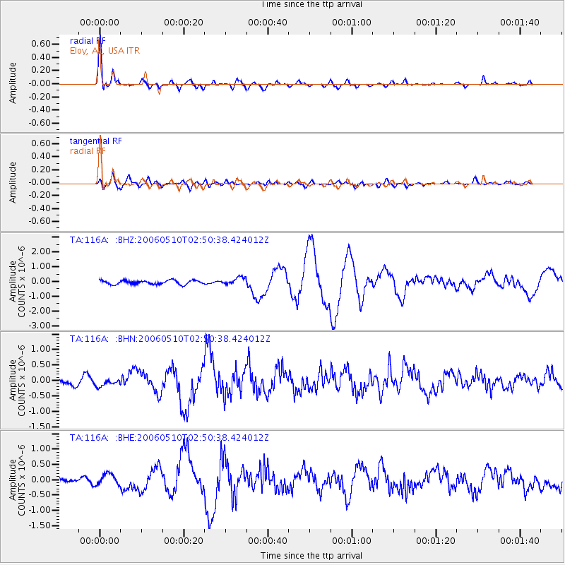
Signal To Noise
| Channel | StoN | STA | LTA |
| TA:116A: :BHN:20060510T02:50:38.424012Z | 1.0903487 | 1.0770855E-7 | 9.878358E-8 |
| TA:116A: :BHE:20060510T02:50:38.424012Z | 2.3936481 | 1.8305491E-7 | 7.647528E-8 |
| TA:116A: :BHZ:20060510T02:50:38.424012Z | 1.9009573 | 2.492311E-7 | 1.311082E-7 |
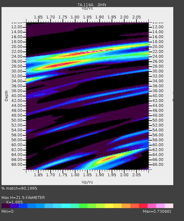
| Arrivals | |
| Ps | 3.2 SECOND |
| PpPs | 9.3 SECOND |
| PsPs/PpSs | 13 SECOND |

