You are here: Home > Network List > TA - USArray Transportable Network (new EarthScope stations) Stations List
> Station R32K Eaglecrest, AK, USA > Earthquake Result Viewer
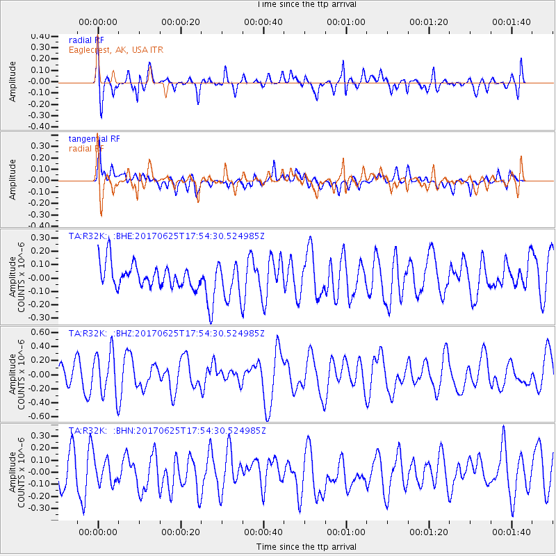
R32K Eaglecrest, AK, USA - Earthquake Result Viewer
*The percent match for this event was below the threshold and hence no stack was calculated.
| Earthquake location: |
Fiji Islands Region |
| Earthquake latitude/longitude: |
-19.7/-176.5 |
| Earthquake time(UTC): |
2017/06/25 (176) 17:42:30 GMT |
| Earthquake Depth: |
38 km |
| Earthquake Magnitude: |
6.2 Mww |
| Earthquake Catalog/Contributor: |
NEIC PDE/us |
|
| Network: |
TA USArray Transportable Network (new EarthScope stations) |
| Station: |
R32K Eaglecrest, AK, USA |
| Lat/Lon: |
58.27 N/134.52 W |
| Elevation: |
386 m |
|
| Distance: |
85.0 deg |
| Az: |
20.764 deg |
| Baz: |
219.217 deg |
| Ray Param: |
$rayparam |
*The percent match for this event was below the threshold and hence was not used in the summary stack. |
|
| Radial Match: |
68.66264 % |
| Radial Bump: |
400 |
| Transverse Match: |
38.07001 % |
| Transverse Bump: |
400 |
| SOD ConfigId: |
13570011 |
| Insert Time: |
2019-04-28 06:55:49.412 +0000 |
| GWidth: |
2.5 |
| Max Bumps: |
400 |
| Tol: |
0.001 |
|
Signal To Noise
| Channel | StoN | STA | LTA |
| TA:R32K: :BHZ:20170625T17:54:30.524985Z | 2.0626874 | 3.1818163E-7 | 1.5425587E-7 |
| TA:R32K: :BHN:20170625T17:54:30.524985Z | 0.5934991 | 9.415524E-8 | 1.5864428E-7 |
| TA:R32K: :BHE:20170625T17:54:30.524985Z | 1.5749321 | 1.3525269E-7 | 8.5878426E-8 |
| Arrivals |
| Ps | |
| PpPs | |
| PsPs/PpSs | |


