You are here: Home > Network List > UW - Pacific Northwest Regional Seismic Network Stations List
> Station MRBL Marblemount, WA, USA > Earthquake Result Viewer
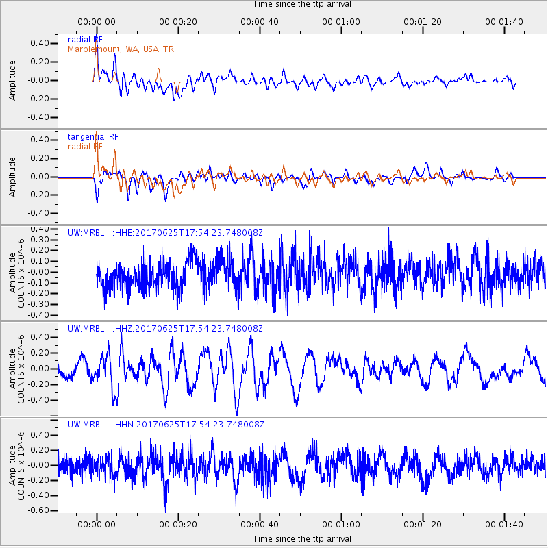
MRBL Marblemount, WA, USA - Earthquake Result Viewer
*The percent match for this event was below the threshold and hence no stack was calculated.
| Earthquake location: |
Fiji Islands Region |
| Earthquake latitude/longitude: |
-19.7/-176.5 |
| Earthquake time(UTC): |
2017/06/25 (176) 17:42:30 GMT |
| Earthquake Depth: |
38 km |
| Earthquake Magnitude: |
6.2 Mww |
| Earthquake Catalog/Contributor: |
NEIC PDE/us |
|
| Network: |
UW Pacific Northwest Regional Seismic Network |
| Station: |
MRBL Marblemount, WA, USA |
| Lat/Lon: |
48.52 N/121.48 W |
| Elevation: |
75 m |
|
| Distance: |
83.7 deg |
| Az: |
33.216 deg |
| Baz: |
230.935 deg |
| Ray Param: |
$rayparam |
*The percent match for this event was below the threshold and hence was not used in the summary stack. |
|
| Radial Match: |
68.968834 % |
| Radial Bump: |
400 |
| Transverse Match: |
63.910484 % |
| Transverse Bump: |
400 |
| SOD ConfigId: |
13570011 |
| Insert Time: |
2019-04-28 06:56:40.844 +0000 |
| GWidth: |
2.5 |
| Max Bumps: |
400 |
| Tol: |
0.001 |
|
Signal To Noise
| Channel | StoN | STA | LTA |
| UW:MRBL: :HHZ:20170625T17:54:23.748008Z | 2.2646358 | 2.1091958E-7 | 9.313621E-8 |
| UW:MRBL: :HHN:20170625T17:54:23.748008Z | 1.2651912 | 1.2184154E-7 | 9.630286E-8 |
| UW:MRBL: :HHE:20170625T17:54:23.748008Z | 1.2539214 | 1.4824617E-7 | 1.1822604E-7 |
| Arrivals |
| Ps | |
| PpPs | |
| PsPs/PpSs | |


