You are here: Home > Network List > TA - USArray Transportable Network (new EarthScope stations) Stations List
> Station 116A Eloy, AZ, USA > Earthquake Result Viewer
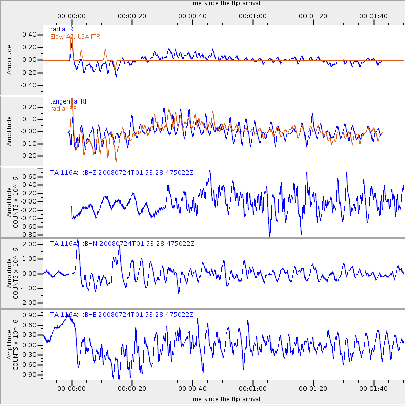
116A Eloy, AZ, USA - Earthquake Result Viewer
*The percent match for this event was below the threshold and hence no stack was calculated.
| Earthquake location: |
Kuril Islands |
| Earthquake latitude/longitude: |
51.0/157.6 |
| Earthquake time(UTC): |
2008/07/24 (206) 01:43:16 GMT |
| Earthquake Depth: |
27 km |
| Earthquake Magnitude: |
6.0 MB, 6.0 MS, 6.2 MW, 6.2 MW |
| Earthquake Catalog/Contributor: |
WHDF/NEIC |
|
| Network: |
TA USArray Transportable Network (new EarthScope stations) |
| Station: |
116A Eloy, AZ, USA |
| Lat/Lon: |
32.56 N/111.70 W |
| Elevation: |
477 m |
|
| Distance: |
65.9 deg |
| Az: |
67.67 deg |
| Baz: |
316.16 deg |
| Ray Param: |
$rayparam |
*The percent match for this event was below the threshold and hence was not used in the summary stack. |
|
| Radial Match: |
37.297348 % |
| Radial Bump: |
400 |
| Transverse Match: |
59.934 % |
| Transverse Bump: |
400 |
| SOD ConfigId: |
2504 |
| Insert Time: |
2010-03-06 01:21:59.582 +0000 |
| GWidth: |
2.5 |
| Max Bumps: |
400 |
| Tol: |
0.001 |
|
Signal To Noise
| Channel | StoN | STA | LTA |
| TA:116A: :BHN:20080724T01:53:28.475022Z | 7.596221 | 9.1801496E-7 | 1.2085154E-7 |
| TA:116A: :BHE:20080724T01:53:28.475022Z | 1.9501305 | 4.953773E-7 | 2.5402264E-7 |
| TA:116A: :BHZ:20080724T01:53:28.475022Z | 1.2733848 | 1.8891707E-7 | 1.4835818E-7 |
| Arrivals |
| Ps | |
| PpPs | |
| PsPs/PpSs | |


