You are here: Home > Network List > AV - Alaska Volcano Observatory Stations List
> Station AMKA Regional Station, Amchitka Island, Alaska > Earthquake Result Viewer
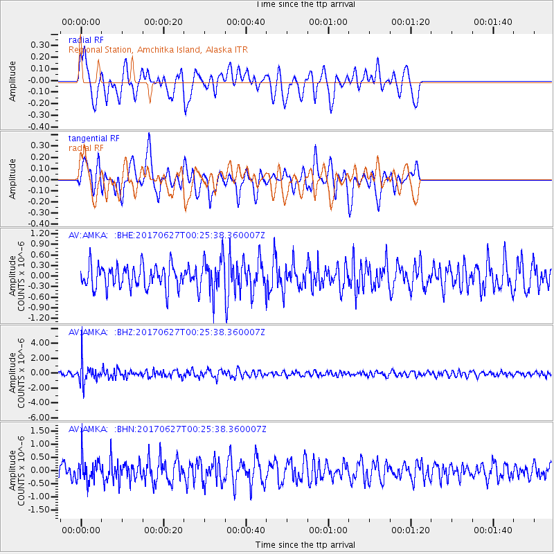
AMKA Regional Station, Amchitka Island, Alaska - Earthquake Result Viewer
*The percent match for this event was below the threshold and hence no stack was calculated.
| Earthquake location: |
South Of Fiji Islands |
| Earthquake latitude/longitude: |
-24.8/-177.2 |
| Earthquake time(UTC): |
2017/06/27 (178) 00:14:37 GMT |
| Earthquake Depth: |
132 km |
| Earthquake Magnitude: |
5.5 Mww |
| Earthquake Catalog/Contributor: |
NEIC PDE/us |
|
| Network: |
AV Alaska Volcano Observatory |
| Station: |
AMKA Regional Station, Amchitka Island, Alaska |
| Lat/Lon: |
51.38 N/179.30 E |
| Elevation: |
116 m |
|
| Distance: |
75.9 deg |
| Az: |
357.751 deg |
| Baz: |
176.737 deg |
| Ray Param: |
$rayparam |
*The percent match for this event was below the threshold and hence was not used in the summary stack. |
|
| Radial Match: |
61.708168 % |
| Radial Bump: |
400 |
| Transverse Match: |
64.23094 % |
| Transverse Bump: |
400 |
| SOD ConfigId: |
13570011 |
| Insert Time: |
2019-04-28 06:58:40.923 +0000 |
| GWidth: |
2.5 |
| Max Bumps: |
400 |
| Tol: |
0.001 |
|
Signal To Noise
| Channel | StoN | STA | LTA |
| AV:AMKA: :BHZ:20170627T00:25:38.360007Z | 4.2184777 | 1.4461722E-6 | 3.4281848E-7 |
| AV:AMKA: :BHN:20170627T00:25:38.360007Z | 1.525468 | 4.7174555E-7 | 3.0924645E-7 |
| AV:AMKA: :BHE:20170627T00:25:38.360007Z | 1.5605438 | 4.958927E-7 | 3.1776918E-7 |
| Arrivals |
| Ps | |
| PpPs | |
| PsPs/PpSs | |


