You are here: Home > Network List > AV - Alaska Volcano Observatory Stations List
> Station SPCR Ckakachatna River, Mount Spurr, Alaska > Earthquake Result Viewer
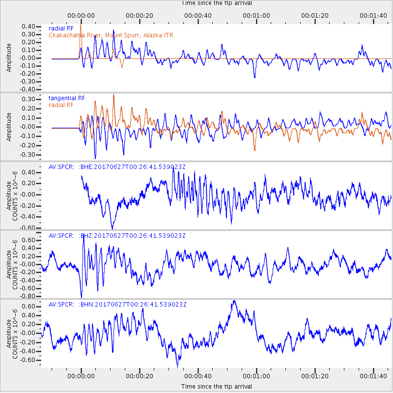
SPCR Ckakachatna River, Mount Spurr, Alaska - Earthquake Result Viewer
*The percent match for this event was below the threshold and hence no stack was calculated.
| Earthquake location: |
South Of Fiji Islands |
| Earthquake latitude/longitude: |
-24.8/-177.2 |
| Earthquake time(UTC): |
2017/06/27 (178) 00:14:37 GMT |
| Earthquake Depth: |
132 km |
| Earthquake Magnitude: |
5.5 Mww |
| Earthquake Catalog/Contributor: |
NEIC PDE/us |
|
| Network: |
AV Alaska Volcano Observatory |
| Station: |
SPCR Ckakachatna River, Mount Spurr, Alaska |
| Lat/Lon: |
61.20 N/152.21 W |
| Elevation: |
984 m |
|
| Distance: |
88.0 deg |
| Az: |
11.819 deg |
| Baz: |
202.609 deg |
| Ray Param: |
$rayparam |
*The percent match for this event was below the threshold and hence was not used in the summary stack. |
|
| Radial Match: |
55.858574 % |
| Radial Bump: |
400 |
| Transverse Match: |
49.65089 % |
| Transverse Bump: |
400 |
| SOD ConfigId: |
13570011 |
| Insert Time: |
2019-04-28 06:58:50.965 +0000 |
| GWidth: |
2.5 |
| Max Bumps: |
400 |
| Tol: |
0.001 |
|
Signal To Noise
| Channel | StoN | STA | LTA |
| AV:SPCR: :BHZ:20170627T00:26:41.539023Z | 3.1051335 | 3.6885206E-7 | 1.1878782E-7 |
| AV:SPCR: :BHN:20170627T00:26:41.539023Z | 0.9377708 | 2.3047336E-7 | 2.4576727E-7 |
| AV:SPCR: :BHE:20170627T00:26:41.539023Z | 1.3418716 | 2.6112133E-7 | 1.9459486E-7 |
| Arrivals |
| Ps | |
| PpPs | |
| PsPs/PpSs | |


