You are here: Home > Network List > TA - USArray Transportable Network (new EarthScope stations) Stations List
> Station O17K Koliganek, Bristol Bay, AK, USA > Earthquake Result Viewer
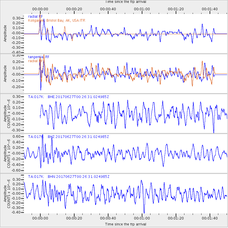
O17K Koliganek, Bristol Bay, AK, USA - Earthquake Result Viewer
*The percent match for this event was below the threshold and hence no stack was calculated.
| Earthquake location: |
South Of Fiji Islands |
| Earthquake latitude/longitude: |
-24.8/-177.2 |
| Earthquake time(UTC): |
2017/06/27 (178) 00:14:37 GMT |
| Earthquake Depth: |
132 km |
| Earthquake Magnitude: |
5.5 Mww |
| Earthquake Catalog/Contributor: |
NEIC PDE/us |
|
| Network: |
TA USArray Transportable Network (new EarthScope stations) |
| Station: |
O17K Koliganek, Bristol Bay, AK, USA |
| Lat/Lon: |
59.77 N/157.09 W |
| Elevation: |
156 m |
|
| Distance: |
85.9 deg |
| Az: |
10.05 deg |
| Baz: |
198.27 deg |
| Ray Param: |
$rayparam |
*The percent match for this event was below the threshold and hence was not used in the summary stack. |
|
| Radial Match: |
51.11046 % |
| Radial Bump: |
400 |
| Transverse Match: |
49.14612 % |
| Transverse Bump: |
400 |
| SOD ConfigId: |
13570011 |
| Insert Time: |
2019-04-28 07:03:03.340 +0000 |
| GWidth: |
2.5 |
| Max Bumps: |
400 |
| Tol: |
0.001 |
|
Signal To Noise
| Channel | StoN | STA | LTA |
| TA:O17K: :BHZ:20170627T00:26:31.024985Z | 3.1552916 | 2.9946747E-7 | 9.490961E-8 |
| TA:O17K: :BHN:20170627T00:26:31.024985Z | 1.3159338 | 1.4704703E-7 | 1.1174349E-7 |
| TA:O17K: :BHE:20170627T00:26:31.024985Z | 1.0551841 | 1.1661802E-7 | 1.1051912E-7 |
| Arrivals |
| Ps | |
| PpPs | |
| PsPs/PpSs | |


