You are here: Home > Network List > TA - USArray Transportable Network (new EarthScope stations) Stations List
> Station 116A Eloy, AZ, USA > Earthquake Result Viewer
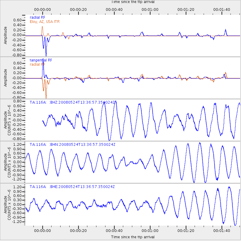
116A Eloy, AZ, USA - Earthquake Result Viewer
*The percent match for this event was below the threshold and hence no stack was calculated.
| Earthquake location: |
Solomon Islands |
| Earthquake latitude/longitude: |
-7.2/156.1 |
| Earthquake time(UTC): |
2008/05/24 (145) 13:24:05 GMT |
| Earthquake Depth: |
29 km |
| Earthquake Magnitude: |
5.8 MB, 5.5 MS, 5.9 MW, 5.8 MW |
| Earthquake Catalog/Contributor: |
WHDF/NEIC |
|
| Network: |
TA USArray Transportable Network (new EarthScope stations) |
| Station: |
116A Eloy, AZ, USA |
| Lat/Lon: |
32.56 N/111.70 W |
| Elevation: |
477 m |
|
| Distance: |
95.7 deg |
| Az: |
57.993 deg |
| Baz: |
265.145 deg |
| Ray Param: |
$rayparam |
*The percent match for this event was below the threshold and hence was not used in the summary stack. |
|
| Radial Match: |
94.85679 % |
| Radial Bump: |
388 |
| Transverse Match: |
84.17532 % |
| Transverse Bump: |
244 |
| SOD ConfigId: |
2504 |
| Insert Time: |
2010-03-06 01:22:38.941 +0000 |
| GWidth: |
2.5 |
| Max Bumps: |
400 |
| Tol: |
0.001 |
|
Signal To Noise
| Channel | StoN | STA | LTA |
| TA:116A: :BHN:20080524T13:36:57.350024Z | 1.8018011 | 6.004676E-7 | 3.3325966E-7 |
| TA:116A: :BHE:20080524T13:36:57.350024Z | 0.98398703 | 2.0120262E-7 | 2.044769E-7 |
| TA:116A: :BHZ:20080524T13:36:57.350024Z | 2.5421495 | 5.035486E-7 | 1.9807986E-7 |
| Arrivals |
| Ps | |
| PpPs | |
| PsPs/PpSs | |


