You are here: Home > Network List > TA - USArray Transportable Network (new EarthScope stations) Stations List
> Station J25K Salcha River, AK, USA > Earthquake Result Viewer
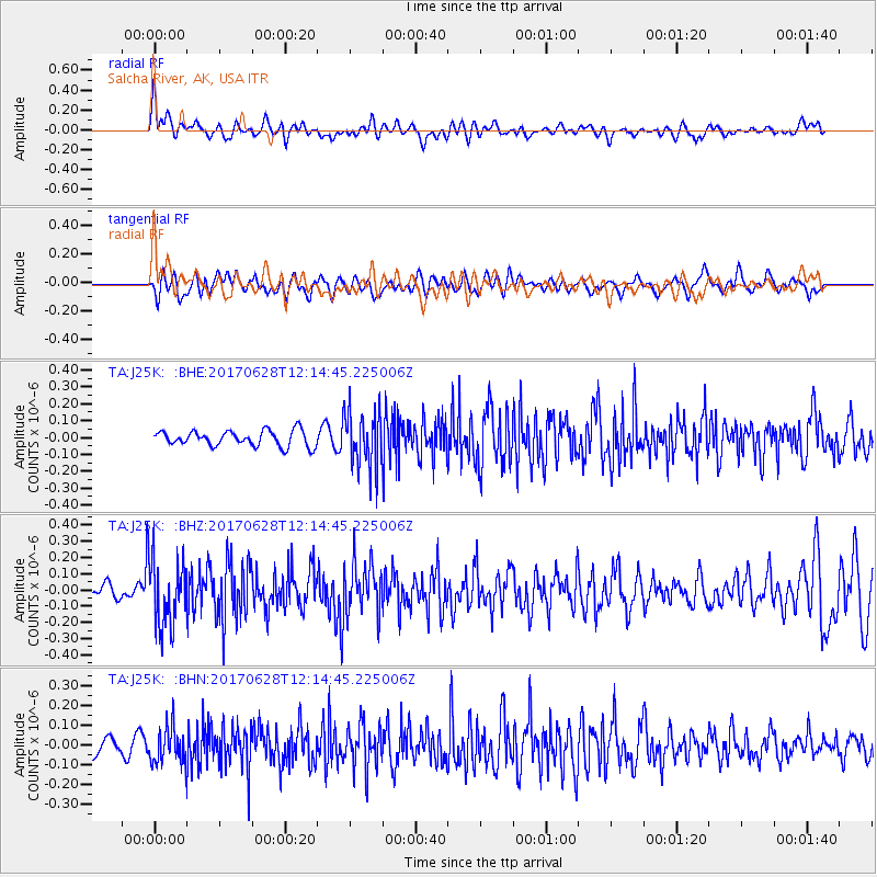
J25K Salcha River, AK, USA - Earthquake Result Viewer
*The percent match for this event was below the threshold and hence no stack was calculated.
| Earthquake location: |
Kuril Islands |
| Earthquake latitude/longitude: |
43.7/148.0 |
| Earthquake time(UTC): |
2017/06/28 (179) 12:07:30 GMT |
| Earthquake Depth: |
49 km |
| Earthquake Magnitude: |
5.4 Mww |
| Earthquake Catalog/Contributor: |
NEIC PDE/us |
|
| Network: |
TA USArray Transportable Network (new EarthScope stations) |
| Station: |
J25K Salcha River, AK, USA |
| Lat/Lon: |
64.61 N/145.37 W |
| Elevation: |
949 m |
|
| Distance: |
41.8 deg |
| Az: |
36.411 deg |
| Baz: |
273.234 deg |
| Ray Param: |
$rayparam |
*The percent match for this event was below the threshold and hence was not used in the summary stack. |
|
| Radial Match: |
58.719906 % |
| Radial Bump: |
400 |
| Transverse Match: |
54.897064 % |
| Transverse Bump: |
400 |
| SOD ConfigId: |
13570011 |
| Insert Time: |
2019-04-28 07:13:42.893 +0000 |
| GWidth: |
2.5 |
| Max Bumps: |
400 |
| Tol: |
0.001 |
|
Signal To Noise
| Channel | StoN | STA | LTA |
| TA:J25K: :BHZ:20170628T12:14:45.225006Z | 3.8264682 | 2.076242E-7 | 5.4260006E-8 |
| TA:J25K: :BHN:20170628T12:14:45.225006Z | 1.5703552 | 9.1181164E-8 | 5.806404E-8 |
| TA:J25K: :BHE:20170628T12:14:45.225006Z | 3.5537052 | 1.6226385E-7 | 4.5660467E-8 |
| Arrivals |
| Ps | |
| PpPs | |
| PsPs/PpSs | |


