You are here: Home > Network List > TA - USArray Transportable Network (new EarthScope stations) Stations List
> Station M16K Timber Creek, AK, USA > Earthquake Result Viewer
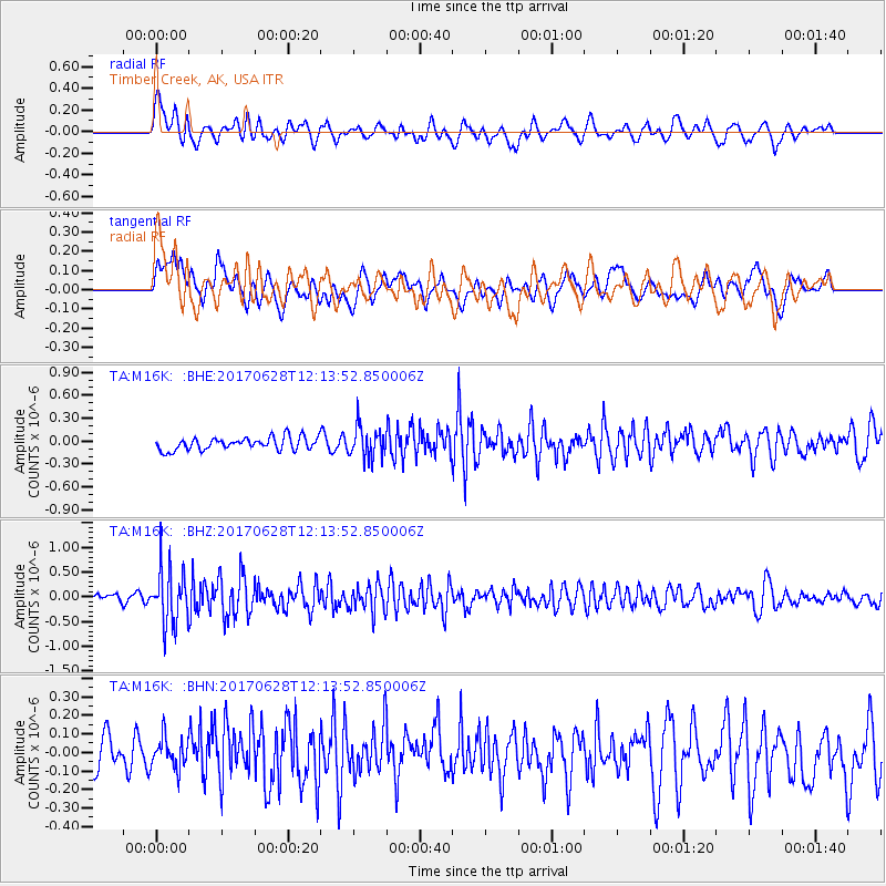
M16K Timber Creek, AK, USA - Earthquake Result Viewer
*The percent match for this event was below the threshold and hence no stack was calculated.
| Earthquake location: |
Kuril Islands |
| Earthquake latitude/longitude: |
43.7/148.0 |
| Earthquake time(UTC): |
2017/06/28 (179) 12:07:30 GMT |
| Earthquake Depth: |
49 km |
| Earthquake Magnitude: |
5.4 Mww |
| Earthquake Catalog/Contributor: |
NEIC PDE/us |
|
| Network: |
TA USArray Transportable Network (new EarthScope stations) |
| Station: |
M16K Timber Creek, AK, USA |
| Lat/Lon: |
61.02 N/158.96 W |
| Elevation: |
394 m |
|
| Distance: |
35.5 deg |
| Az: |
42.032 deg |
| Baz: |
265.54 deg |
| Ray Param: |
$rayparam |
*The percent match for this event was below the threshold and hence was not used in the summary stack. |
|
| Radial Match: |
67.37268 % |
| Radial Bump: |
400 |
| Transverse Match: |
45.87511 % |
| Transverse Bump: |
400 |
| SOD ConfigId: |
13570011 |
| Insert Time: |
2019-04-28 07:14:12.277 +0000 |
| GWidth: |
2.5 |
| Max Bumps: |
400 |
| Tol: |
0.001 |
|
Signal To Noise
| Channel | StoN | STA | LTA |
| TA:M16K: :BHZ:20170628T12:13:52.850006Z | 6.35945 | 5.620545E-7 | 8.838099E-8 |
| TA:M16K: :BHN:20170628T12:13:52.850006Z | 0.82459253 | 8.665081E-8 | 1.0508319E-7 |
| TA:M16K: :BHE:20170628T12:13:52.850006Z | 2.4716141 | 2.0530493E-7 | 8.306512E-8 |
| Arrivals |
| Ps | |
| PpPs | |
| PsPs/PpSs | |


