You are here: Home > Network List > CI - Caltech Regional Seismic Network Stations List
> Station ARV Arvin, Arvin, CA, USA > Earthquake Result Viewer
ARV Arvin, Arvin, CA, USA - Earthquake Result Viewer

| Earthquake location: |
Near Coast Of Peru |
| Earthquake latitude/longitude: |
-13.4/-76.6 |
| Earthquake time(UTC): |
2007/08/15 (227) 23:40:57 GMT |
| Earthquake Depth: |
39 km |
| Earthquake Magnitude: |
6.7 MB, 7.9 MS, 8.0 MW, 7.5 ME |
| Earthquake Catalog/Contributor: |
WHDF/NEIC |
|
| Network: |
CI Caltech Regional Seismic Network |
| Station: |
ARV Arvin, Arvin, CA, USA |
| Lat/Lon: |
35.13 N/118.83 W |
| Elevation: |
258 m |
|
| Distance: |
62.7 deg |
| Az: |
321.681 deg |
| Baz: |
132.596 deg |
| Ray Param: |
0.05999424 |
| Estimated Moho Depth: |
18.75 km |
| Estimated Crust Vp/Vs: |
1.60 |
| Assumed Crust Vp: |
6.1 km/s |
| Estimated Crust Vs: |
3.812 km/s |
| Estimated Crust Poisson's Ratio: |
0.18 |
|
| Radial Match: |
95.00178 % |
| Radial Bump: |
400 |
| Transverse Match: |
92.32863 % |
| Transverse Bump: |
400 |
| SOD ConfigId: |
2564 |
| Insert Time: |
2010-02-26 01:17:58.156 +0000 |
| GWidth: |
2.5 |
| Max Bumps: |
400 |
| Tol: |
0.001 |
|
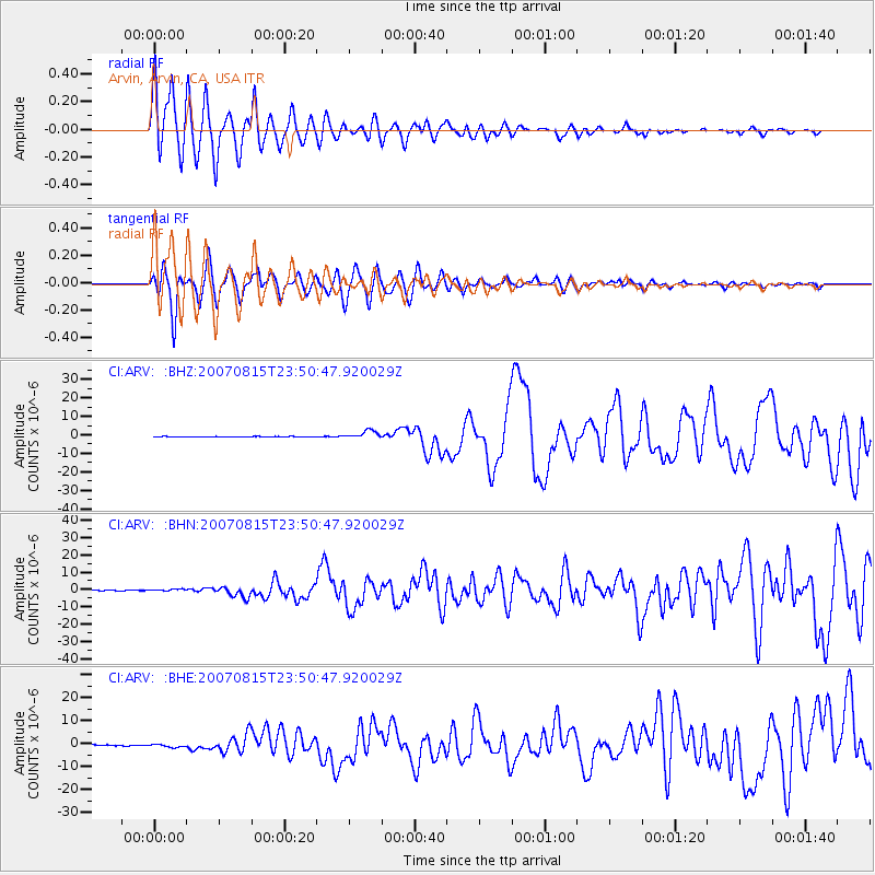
Signal To Noise
| Channel | StoN | STA | LTA |
| CI:ARV: :BHN:20070815T23:50:47.920029Z | 2.7676284 | 6.2916183E-7 | 2.2732887E-7 |
| CI:ARV: :BHE:20070815T23:50:47.920029Z | 2.3255525 | 6.5344835E-7 | 2.8098628E-7 |
| CI:ARV: :BHZ:20070815T23:50:47.920029Z | 14.532703 | 2.2044776E-6 | 1.5169081E-7 |
| Arrivals |
| Ps | 1.9 SECOND |
| PpPs | 7.6 SECOND |
| PsPs/PpSs | 9.6 SECOND |


