You are here: Home > Network List > TA - USArray Transportable Network (new EarthScope stations) Stations List
> Station W22A Albuquerque, NM, USA > Earthquake Result Viewer
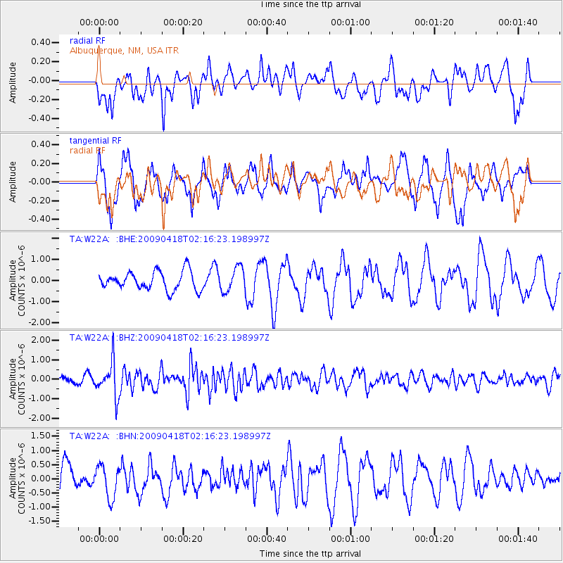
W22A Albuquerque, NM, USA - Earthquake Result Viewer
*The percent match for this event was below the threshold and hence no stack was calculated.
| Earthquake location: |
Kermadec Islands Region |
| Earthquake latitude/longitude: |
-28.9/-177.4 |
| Earthquake time(UTC): |
2009/04/18 (108) 02:03:52 GMT |
| Earthquake Depth: |
65 km |
| Earthquake Magnitude: |
6.0 MB, 5.8 MW, 5.7 MW |
| Earthquake Catalog/Contributor: |
WHDF/NEIC |
|
| Network: |
TA USArray Transportable Network (new EarthScope stations) |
| Station: |
W22A Albuquerque, NM, USA |
| Lat/Lon: |
35.07 N/106.87 W |
| Elevation: |
1813 m |
|
| Distance: |
92.1 deg |
| Az: |
50.72 deg |
| Baz: |
235.828 deg |
| Ray Param: |
$rayparam |
*The percent match for this event was below the threshold and hence was not used in the summary stack. |
|
| Radial Match: |
62.62817 % |
| Radial Bump: |
400 |
| Transverse Match: |
69.088806 % |
| Transverse Bump: |
396 |
| SOD ConfigId: |
2658 |
| Insert Time: |
2010-03-06 01:27:27.588 +0000 |
| GWidth: |
2.5 |
| Max Bumps: |
400 |
| Tol: |
0.001 |
|
Signal To Noise
| Channel | StoN | STA | LTA |
| TA:W22A: :BHZ:20090418T02:16:23.198997Z | 4.73814 | 9.136466E-7 | 1.9282811E-7 |
| TA:W22A: :BHN:20090418T02:16:23.198997Z | 0.77053475 | 5.8401093E-7 | 7.5792934E-7 |
| TA:W22A: :BHE:20090418T02:16:23.198997Z | 1.3602444 | 5.92073E-7 | 4.3526956E-7 |
| Arrivals |
| Ps | |
| PpPs | |
| PsPs/PpSs | |


