You are here: Home > Network List > TA - USArray Transportable Network (new EarthScope stations) Stations List
> Station G23K Bananza Creek, AK, USA > Earthquake Result Viewer
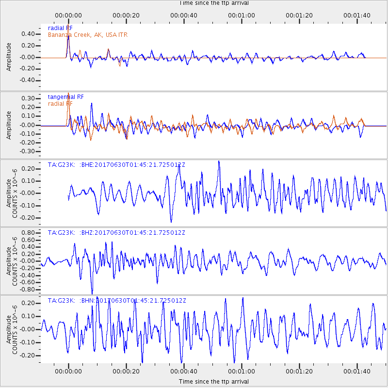
G23K Bananza Creek, AK, USA - Earthquake Result Viewer
*The percent match for this event was below the threshold and hence no stack was calculated.
| Earthquake location: |
Northern Mid-Atlantic Ridge |
| Earthquake latitude/longitude: |
33.7/-38.5 |
| Earthquake time(UTC): |
2017/06/30 (181) 01:34:58 GMT |
| Earthquake Depth: |
10 km |
| Earthquake Magnitude: |
5.8 Mwb |
| Earthquake Catalog/Contributor: |
NEIC PDE/us |
|
| Network: |
TA USArray Transportable Network (new EarthScope stations) |
| Station: |
G23K Bananza Creek, AK, USA |
| Lat/Lon: |
66.71 N/150.02 W |
| Elevation: |
746 m |
|
| Distance: |
67.3 deg |
| Az: |
336.352 deg |
| Baz: |
57.195 deg |
| Ray Param: |
$rayparam |
*The percent match for this event was below the threshold and hence was not used in the summary stack. |
|
| Radial Match: |
69.16068 % |
| Radial Bump: |
395 |
| Transverse Match: |
76.607765 % |
| Transverse Bump: |
400 |
| SOD ConfigId: |
13570011 |
| Insert Time: |
2019-04-28 07:36:00.745 +0000 |
| GWidth: |
2.5 |
| Max Bumps: |
400 |
| Tol: |
0.001 |
|
Signal To Noise
| Channel | StoN | STA | LTA |
| TA:G23K: :BHZ:20170630T01:45:21.725012Z | 4.0881405 | 2.2846713E-7 | 5.5885344E-8 |
| TA:G23K: :BHN:20170630T01:45:21.725012Z | 1.7648151 | 8.7360625E-8 | 4.9501292E-8 |
| TA:G23K: :BHE:20170630T01:45:21.725012Z | 1.2348793 | 6.7468235E-8 | 5.4635493E-8 |
| Arrivals |
| Ps | |
| PpPs | |
| PsPs/PpSs | |


