You are here: Home > Network List > TJ - Tajikistan National Seismic Network Stations List
> Station GARM Garm, Tajikistan > Earthquake Result Viewer
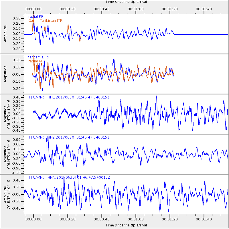
GARM Garm, Tajikistan - Earthquake Result Viewer
*The percent match for this event was below the threshold and hence no stack was calculated.
| Earthquake location: |
Northern Mid-Atlantic Ridge |
| Earthquake latitude/longitude: |
33.7/-38.5 |
| Earthquake time(UTC): |
2017/06/30 (181) 01:34:58 GMT |
| Earthquake Depth: |
10 km |
| Earthquake Magnitude: |
5.8 Mwb |
| Earthquake Catalog/Contributor: |
NEIC PDE/us |
|
| Network: |
TJ Tajikistan National Seismic Network |
| Station: |
GARM Garm, Tajikistan |
| Lat/Lon: |
39.00 N/70.32 E |
| Elevation: |
1305 m |
|
| Distance: |
82.1 deg |
| Az: |
48.103 deg |
| Baz: |
307.258 deg |
| Ray Param: |
$rayparam |
*The percent match for this event was below the threshold and hence was not used in the summary stack. |
|
| Radial Match: |
63.033085 % |
| Radial Bump: |
400 |
| Transverse Match: |
69.342285 % |
| Transverse Bump: |
400 |
| SOD ConfigId: |
13570011 |
| Insert Time: |
2019-04-28 07:36:51.881 +0000 |
| GWidth: |
2.5 |
| Max Bumps: |
400 |
| Tol: |
0.001 |
|
Signal To Noise
| Channel | StoN | STA | LTA |
| TJ:GARM: :HHZ:20170630T01:46:47.540015Z | 3.1579826 | 2.118973E-7 | 6.7098945E-8 |
| TJ:GARM: :HHN:20170630T01:46:47.540015Z | 1.4403672 | 1.0059675E-7 | 6.984104E-8 |
| TJ:GARM: :HHE:20170630T01:46:47.540015Z | 1.5034771 | 9.442506E-8 | 6.280446E-8 |
| Arrivals |
| Ps | |
| PpPs | |
| PsPs/PpSs | |


