You are here: Home > Network List > US - United States National Seismic Network Stations List
> Station HAWA Hanford, Washington, USA > Earthquake Result Viewer
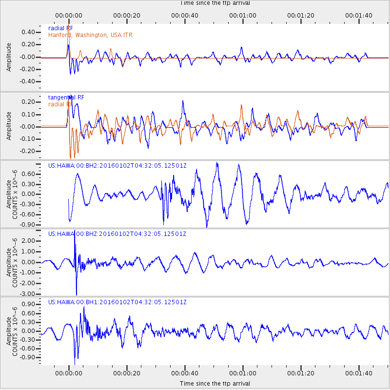
HAWA Hanford, Washington, USA - Earthquake Result Viewer
*The percent match for this event was below the threshold and hence no stack was calculated.
| Earthquake location: |
Northeastern China |
| Earthquake latitude/longitude: |
44.9/130.0 |
| Earthquake time(UTC): |
2016/01/02 (002) 04:22:19 GMT |
| Earthquake Depth: |
583 km |
| Earthquake Magnitude: |
5.7 MWP |
| Earthquake Catalog/Contributor: |
NEIC PDE/NEIC COMCAT |
|
| Network: |
US United States National Seismic Network |
| Station: |
HAWA Hanford, Washington, USA |
| Lat/Lon: |
46.39 N/119.53 W |
| Elevation: |
364 m |
|
| Distance: |
70.4 deg |
| Az: |
43.479 deg |
| Baz: |
315.011 deg |
| Ray Param: |
$rayparam |
*The percent match for this event was below the threshold and hence was not used in the summary stack. |
|
| Radial Match: |
62.366947 % |
| Radial Bump: |
400 |
| Transverse Match: |
54.469498 % |
| Transverse Bump: |
400 |
| SOD ConfigId: |
1379111 |
| Insert Time: |
2016-01-16 05:35:50.909 +0000 |
| GWidth: |
2.5 |
| Max Bumps: |
400 |
| Tol: |
0.001 |
|
Signal To Noise
| Channel | StoN | STA | LTA |
| US:HAWA:00:BHZ:20160102T04:32:05.12501Z | 2.5476096 | 8.7687715E-7 | 3.4419605E-7 |
| US:HAWA:00:BH1:20160102T04:32:05.12501Z | 2.2487874 | 3.919603E-7 | 1.742985E-7 |
| US:HAWA:00:BH2:20160102T04:32:05.12501Z | 1.2408109 | 3.1040037E-7 | 2.501593E-7 |
| Arrivals |
| Ps | |
| PpPs | |
| PsPs/PpSs | |


