You are here: Home > Network List > CI - Caltech Regional Seismic Network Stations List
> Station ARV Arvin, Arvin, CA, USA > Earthquake Result Viewer
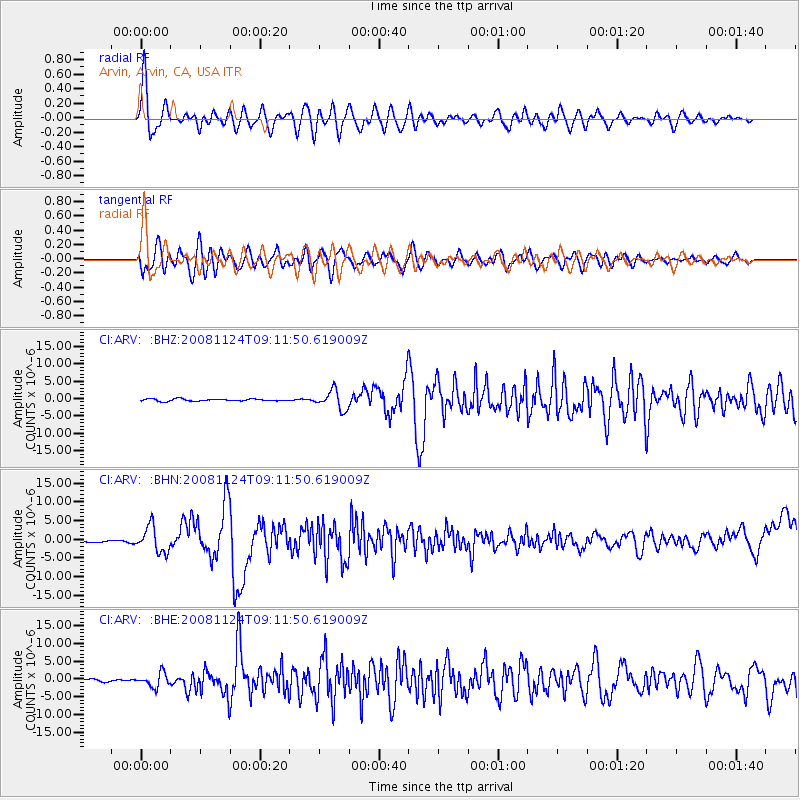
ARV Arvin, Arvin, CA, USA - Earthquake Result Viewer

| Earthquake location: |
Sea Of Okhotsk |
| Earthquake latitude/longitude: |
54.2/154.3 |
| Earthquake time(UTC): |
2008/11/24 (329) 09:02:58 GMT |
| Earthquake Depth: |
492 km |
| Earthquake Magnitude: |
6.5 MB, 7.3 MW, 7.3 MW |
| Earthquake Catalog/Contributor: |
WHDF/NEIC |
|
| Network: |
CI Caltech Regional Seismic Network |
| Station: |
ARV Arvin, Arvin, CA, USA |
| Lat/Lon: |
35.13 N/118.83 W |
| Elevation: |
258 m |
|
| Distance: |
60.7 deg |
| Az: |
69.867 deg |
| Baz: |
317.706 deg |
| Ray Param: |
0.05954197 |
| Estimated Moho Depth: |
42.75 km |
| Estimated Crust Vp/Vs: |
1.60 |
| Assumed Crust Vp: |
6.1 km/s |
| Estimated Crust Vs: |
3.812 km/s |
| Estimated Crust Poisson's Ratio: |
0.18 |
|
| Radial Match: |
83.378746 % |
| Radial Bump: |
400 |
| Transverse Match: |
75.83489 % |
| Transverse Bump: |
400 |
| SOD ConfigId: |
2658 |
| Insert Time: |
2010-02-26 01:18:20.913 +0000 |
| GWidth: |
2.5 |
| Max Bumps: |
400 |
| Tol: |
0.001 |
|
Signal To Noise
| Channel | StoN | STA | LTA |
| CI:ARV: :BHN:20081124T09:11:50.619009Z | 12.744315 | 3.4260547E-6 | 2.6883004E-7 |
| CI:ARV: :BHE:20081124T09:11:50.619009Z | 6.062156 | 1.945519E-6 | 3.2092856E-7 |
| CI:ARV: :BHZ:20081124T09:11:50.619009Z | 8.5428705 | 2.6696828E-6 | 3.1250417E-7 |
| Arrivals |
| Ps | 4.4 SECOND |
| PpPs | 17 SECOND |
| PsPs/PpSs | 22 SECOND |


