You are here: Home > Network List > US - United States National Seismic Network Stations List
> Station MNTX Cornudas Mountains, Texas, USA > Earthquake Result Viewer
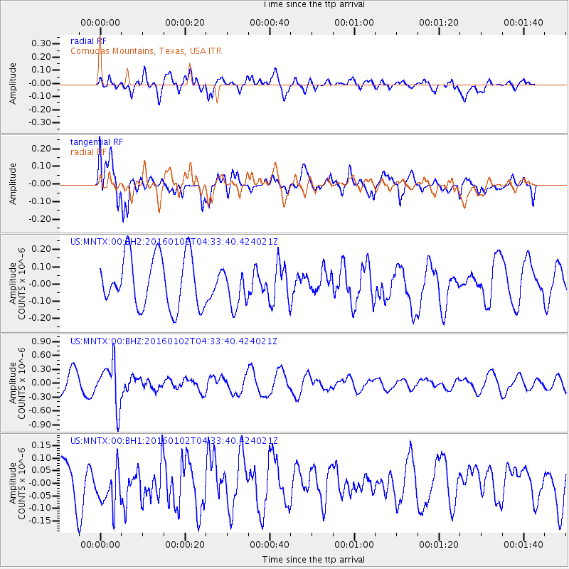
MNTX Cornudas Mountains, Texas, USA - Earthquake Result Viewer
*The percent match for this event was below the threshold and hence no stack was calculated.
| Earthquake location: |
Northeastern China |
| Earthquake latitude/longitude: |
44.9/130.0 |
| Earthquake time(UTC): |
2016/01/02 (002) 04:22:19 GMT |
| Earthquake Depth: |
583 km |
| Earthquake Magnitude: |
5.7 MWP |
| Earthquake Catalog/Contributor: |
NEIC PDE/NEIC COMCAT |
|
| Network: |
US United States National Seismic Network |
| Station: |
MNTX Cornudas Mountains, Texas, USA |
| Lat/Lon: |
31.70 N/105.38 W |
| Elevation: |
404 m |
|
| Distance: |
88.7 deg |
| Az: |
44.54 deg |
| Baz: |
324.185 deg |
| Ray Param: |
$rayparam |
*The percent match for this event was below the threshold and hence was not used in the summary stack. |
|
| Radial Match: |
56.03777 % |
| Radial Bump: |
400 |
| Transverse Match: |
61.115227 % |
| Transverse Bump: |
400 |
| SOD ConfigId: |
1379111 |
| Insert Time: |
2016-01-16 05:36:24.691 +0000 |
| GWidth: |
2.5 |
| Max Bumps: |
400 |
| Tol: |
0.001 |
|
Signal To Noise
| Channel | StoN | STA | LTA |
| US:MNTX:00:BHZ:20160102T04:33:40.424021Z | 2.243028 | 4.829821E-7 | 2.1532594E-7 |
| US:MNTX:00:BH1:20160102T04:33:40.424021Z | 0.9540888 | 8.540304E-8 | 8.951267E-8 |
| US:MNTX:00:BH2:20160102T04:33:40.424021Z | 0.7657095 | 1.1321132E-7 | 1.4785152E-7 |
| Arrivals |
| Ps | |
| PpPs | |
| PsPs/PpSs | |


