You are here: Home > Network List > AZ - ANZA Regional Network Stations List
> Station SMER AZ.SMER > Earthquake Result Viewer
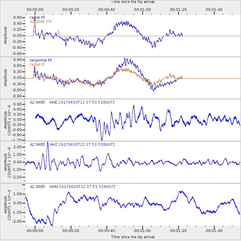
SMER AZ.SMER - Earthquake Result Viewer
*The percent match for this event was below the threshold and hence no stack was calculated.
| Earthquake location: |
Near Coast Of Ecuador |
| Earthquake latitude/longitude: |
-0.3/-80.5 |
| Earthquake time(UTC): |
2017/06/30 (181) 22:29:44 GMT |
| Earthquake Depth: |
7.4 km |
| Earthquake Magnitude: |
6.0 Mww |
| Earthquake Catalog/Contributor: |
NEIC PDE/us |
|
| Network: |
AZ ANZA Regional Network |
| Station: |
SMER AZ.SMER |
| Lat/Lon: |
33.46 N/117.17 W |
| Elevation: |
355 m |
|
| Distance: |
48.1 deg |
| Az: |
317.907 deg |
| Baz: |
126.695 deg |
| Ray Param: |
$rayparam |
*The percent match for this event was below the threshold and hence was not used in the summary stack. |
|
| Radial Match: |
59.910168 % |
| Radial Bump: |
386 |
| Transverse Match: |
58.60173 % |
| Transverse Bump: |
400 |
| SOD ConfigId: |
13570011 |
| Insert Time: |
2019-04-28 07:40:05.482 +0000 |
| GWidth: |
2.5 |
| Max Bumps: |
400 |
| Tol: |
0.001 |
|
Signal To Noise
| Channel | StoN | STA | LTA |
| AZ:SMER: :HHZ:20170630T22:37:53.538007Z | 6.7472258 | 5.8921967E-7 | 8.732769E-8 |
| AZ:SMER: :HHN:20170630T22:37:53.538007Z | 3.6722503 | 2.531212E-6 | 6.892809E-7 |
| AZ:SMER: :HHE:20170630T22:37:53.538007Z | 1.1535258 | 2.5839464E-7 | 2.2400421E-7 |
| Arrivals |
| Ps | |
| PpPs | |
| PsPs/PpSs | |


