You are here: Home > Network List > TA - USArray Transportable Network (new EarthScope stations) Stations List
> Station W25A X Bar L Ranch, Newkirk, NM, USA > Earthquake Result Viewer
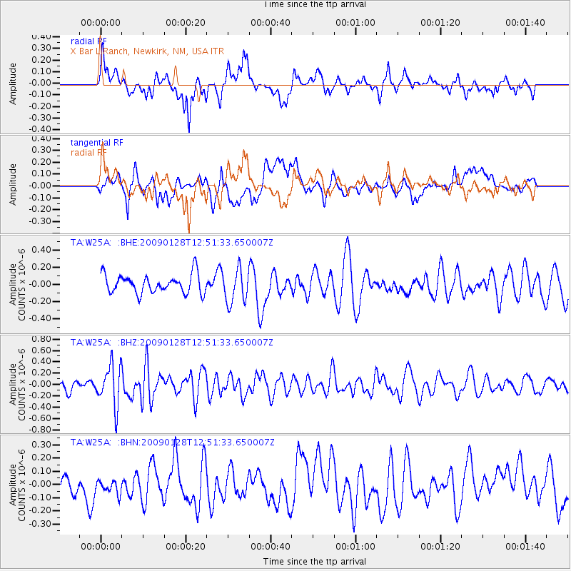
W25A X Bar L Ranch, Newkirk, NM, USA - Earthquake Result Viewer
*The percent match for this event was below the threshold and hence no stack was calculated.
| Earthquake location: |
Samoa Islands Region |
| Earthquake latitude/longitude: |
-17.0/-172.1 |
| Earthquake time(UTC): |
2009/01/28 (028) 12:39:42 GMT |
| Earthquake Depth: |
10 km |
| Earthquake Magnitude: |
5.6 MB, 5.3 MS, 5.5 MW |
| Earthquake Catalog/Contributor: |
WHDF/NEIC |
|
| Network: |
TA USArray Transportable Network (new EarthScope stations) |
| Station: |
W25A X Bar L Ranch, Newkirk, NM, USA |
| Lat/Lon: |
35.22 N/104.46 W |
| Elevation: |
1446 m |
|
| Distance: |
82.4 deg |
| Az: |
49.793 deg |
| Baz: |
243.205 deg |
| Ray Param: |
$rayparam |
*The percent match for this event was below the threshold and hence was not used in the summary stack. |
|
| Radial Match: |
62.261948 % |
| Radial Bump: |
400 |
| Transverse Match: |
52.4012 % |
| Transverse Bump: |
400 |
| SOD ConfigId: |
2658 |
| Insert Time: |
2010-03-06 01:31:52.934 +0000 |
| GWidth: |
2.5 |
| Max Bumps: |
400 |
| Tol: |
0.001 |
|
Signal To Noise
| Channel | StoN | STA | LTA |
| TA:W25A: :BHZ:20090128T12:51:33.650007Z | 3.1109102 | 3.6748145E-7 | 1.18126664E-7 |
| TA:W25A: :BHN:20090128T12:51:33.650007Z | 0.97809017 | 5.986806E-8 | 6.1209136E-8 |
| TA:W25A: :BHE:20090128T12:51:33.650007Z | 1.8304136 | 2.0033252E-7 | 1.0944659E-7 |
| Arrivals |
| Ps | |
| PpPs | |
| PsPs/PpSs | |


