A05A Maple Falls, WA, USA - Earthquake Result Viewer
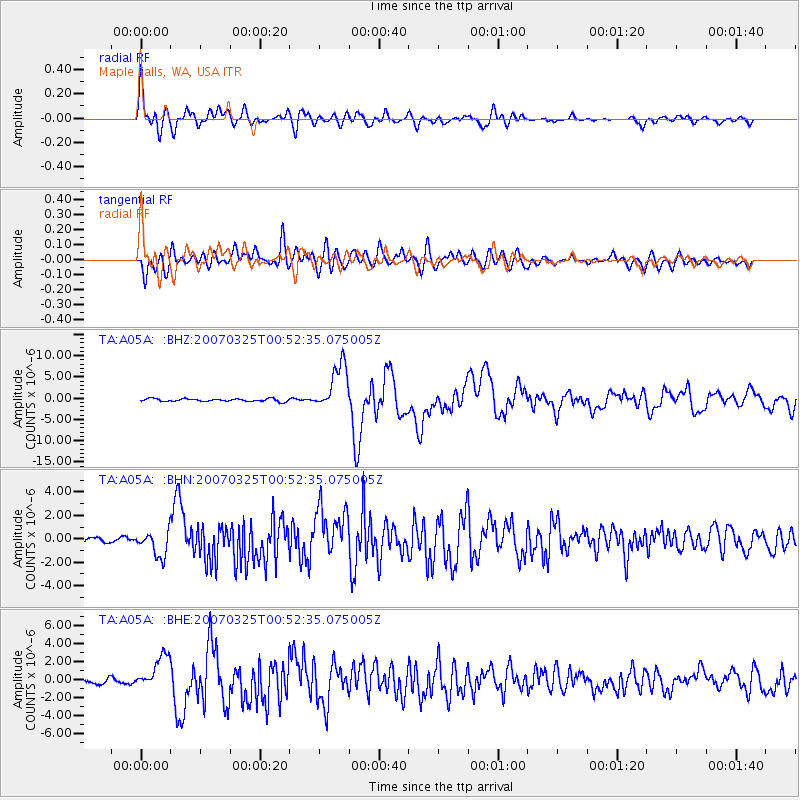
Earthquake location: Near West Coast Of Honshu, Japan
Earthquake latitude/longitude: 37.3/136.6
Earthquake time(UTC): 2007/03/25 (084) 00:41:57 GMT
Earthquake Depth: 8.0 km
Earthquake Magnitude: 6.1 MB, 6.8 MS, 6.7 MW, 6.6 MW
Earthquake Catalog/Contributor: WHDF/NEIC
Network: TA USArray Transportable Network (new EarthScope stations)
Station: A05A Maple Falls, WA, USA
Lat/Lon: 49.00 N/122.09 W
Elevation: 174 m
Distance: 69.4 deg
Az: 43.609 deg
Baz: 303.411 deg
Ray Param: 0.055656705
Estimated Moho Depth: 26.25 km
Estimated Crust Vp/Vs: 2.01
Assumed Crust Vp: 6.566 km/s
Estimated Crust Vs: 3.271 km/s
Estimated Crust Poisson's Ratio: 0.33
Radial Match: 84.89004 %
Radial Bump: 400
Transverse Match: 80.16798 %
Transverse Bump: 400
SOD ConfigId: 2564
Insert Time: 2010-03-06 01:32:12.643 +0000
GWidth: 2.5
Max Bumps: 400
Tol: 0.001

Signal To Noise

ChannelStoNSTALTA
TA:A05A: :BHN:20070325T00:52:35.075005Z5.25873851.0582635E-62.0123903E-7
TA:A05A: :BHE:20070325T00:52:35.075005Z8.0720441.8667644E-62.312629E-7
TA:A05A: :BHZ:20070325T00:52:35.075005Z17.9293425.588434E-63.1169208E-7
Arrivals
Ps4.2 SECOND
PpPs12 SECOND
PsPs/PpSs16 SECOND