You are here: Home > Network List > TA - USArray Transportable Network (new EarthScope stations) Stations List
> Station O17K Koliganek, Bristol Bay, AK, USA > Earthquake Result Viewer
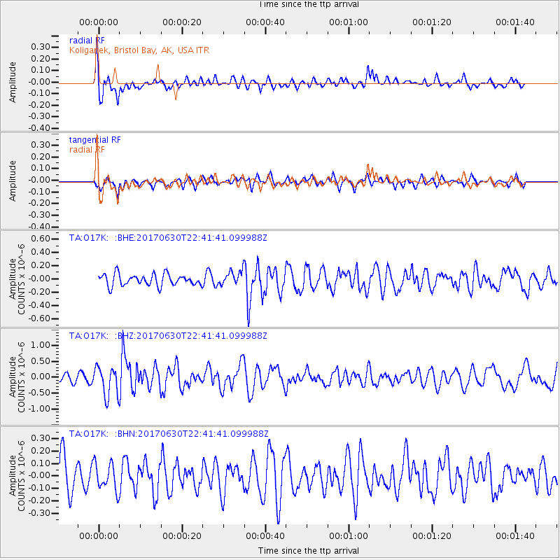
O17K Koliganek, Bristol Bay, AK, USA - Earthquake Result Viewer
*The percent match for this event was below the threshold and hence no stack was calculated.
| Earthquake location: |
Near Coast Of Ecuador |
| Earthquake latitude/longitude: |
-0.3/-80.5 |
| Earthquake time(UTC): |
2017/06/30 (181) 22:29:44 GMT |
| Earthquake Depth: |
7.4 km |
| Earthquake Magnitude: |
6.0 Mww |
| Earthquake Catalog/Contributor: |
NEIC PDE/us |
|
| Network: |
TA USArray Transportable Network (new EarthScope stations) |
| Station: |
O17K Koliganek, Bristol Bay, AK, USA |
| Lat/Lon: |
59.77 N/157.09 W |
| Elevation: |
156 m |
|
| Distance: |
83.5 deg |
| Az: |
330.311 deg |
| Baz: |
101.788 deg |
| Ray Param: |
$rayparam |
*The percent match for this event was below the threshold and hence was not used in the summary stack. |
|
| Radial Match: |
75.68628 % |
| Radial Bump: |
400 |
| Transverse Match: |
57.974777 % |
| Transverse Bump: |
383 |
| SOD ConfigId: |
13570011 |
| Insert Time: |
2019-04-28 07:49:29.261 +0000 |
| GWidth: |
2.5 |
| Max Bumps: |
400 |
| Tol: |
0.001 |
|
Signal To Noise
| Channel | StoN | STA | LTA |
| TA:O17K: :BHZ:20170630T22:41:41.099988Z | 2.5835443 | 4.7661763E-7 | 1.8448209E-7 |
| TA:O17K: :BHN:20170630T22:41:41.099988Z | 0.81953704 | 1.07181734E-7 | 1.3078326E-7 |
| TA:O17K: :BHE:20170630T22:41:41.099988Z | 1.4845349 | 1.2934447E-7 | 8.7127944E-8 |
| Arrivals |
| Ps | |
| PpPs | |
| PsPs/PpSs | |


