
A05A Maple Falls, WA, USA - Earthquake Result Viewer
| ||||||||||||||||||
| ||||||||||||||||||
| ||||||||||||||||||
|
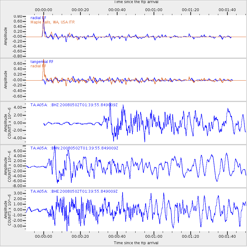
Signal To Noise
| Channel | StoN | STA | LTA |
| TA:A05A: :BHN:20080502T01:39:55.849009Z | 8.833245 | 1.4237255E-6 | 1.6117808E-7 |
| TA:A05A: :BHE:20080502T01:39:55.849009Z | 2.3579237 | 5.0738765E-7 | 2.1518409E-7 |
| TA:A05A: :BHZ:20080502T01:39:55.849009Z | 4.2796965 | 7.667577E-7 | 1.791617E-7 |
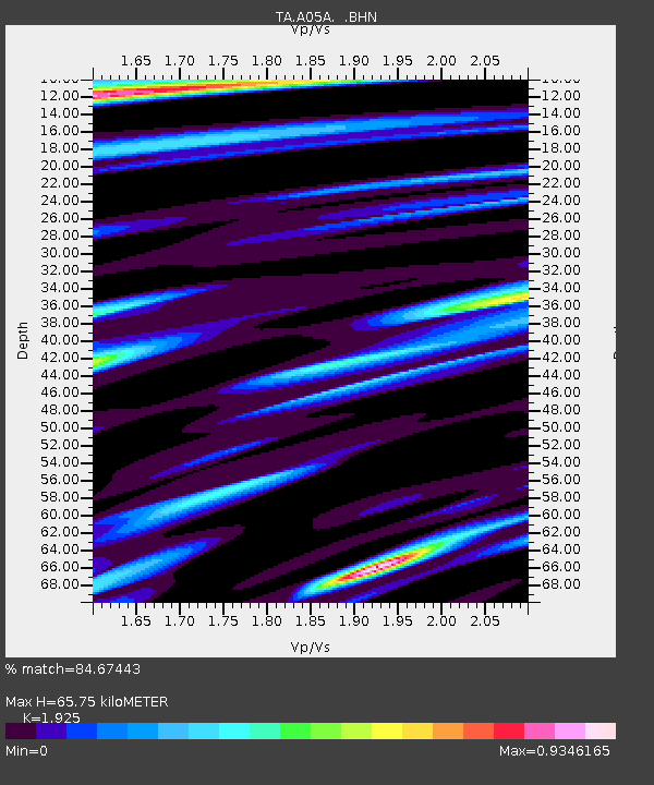
| Arrivals | |
| Ps | 10.0 SECOND |
| PpPs | 27 SECOND |
| PsPs/PpSs | 37 SECOND |

