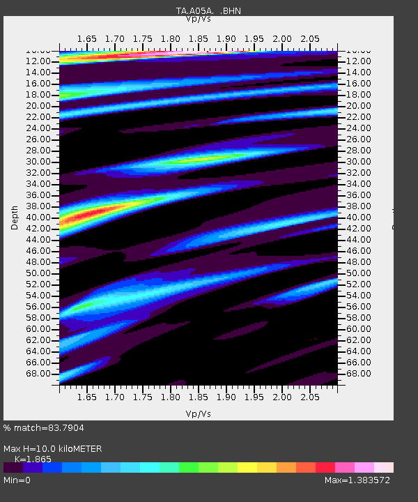
A05A Maple Falls, WA, USA - Earthquake Result Viewer
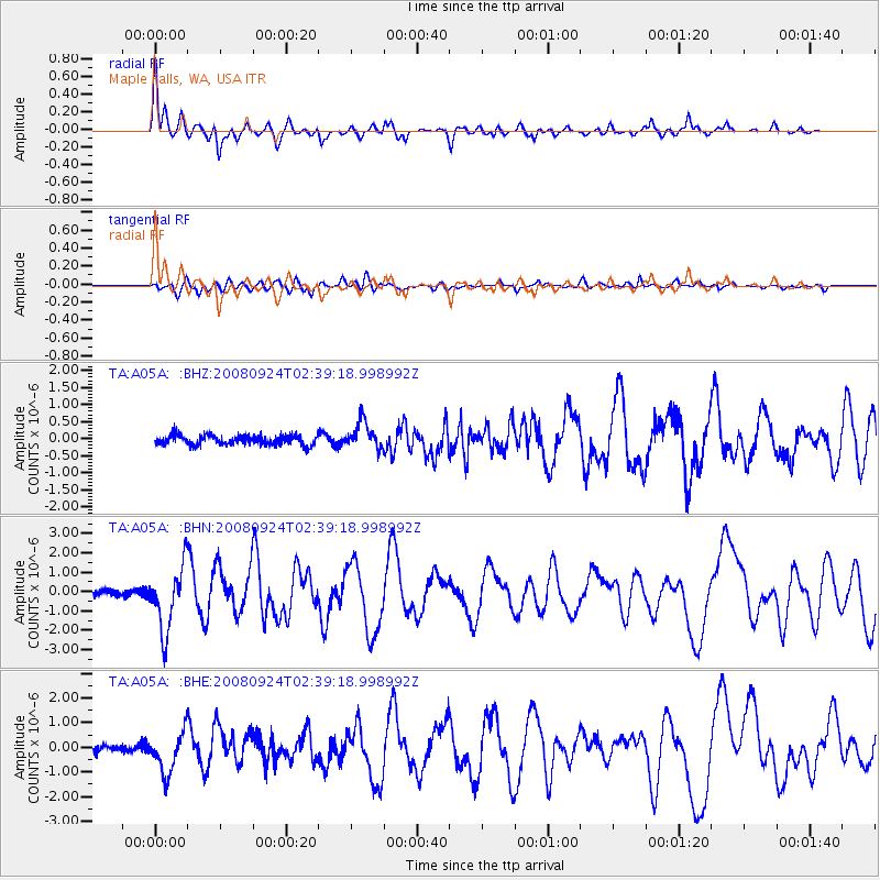
Earthquake location: Off Coast Of Jalisco, Mexico
Earthquake latitude/longitude: 17.6/-105.5
Earthquake time(UTC): 2008/09/24 (268) 02:33:05 GMT
Earthquake Depth: 10 km
Earthquake Magnitude: 5.7 MB, 6.2 MS, 6.4 MW, 6.4 MW
Earthquake Catalog/Contributor: WHDF/NEIC
Network: TA USArray Transportable Network (new EarthScope stations)
Station: A05A Maple Falls, WA, USA
Lat/Lon: 49.00 N/122.09 W
Elevation: 174 m
Distance: 34.1 deg
Az: 340.4 deg
Baz: 150.936 deg
Ray Param: 0.07791044
Estimated Moho Depth: 10.0 km
Estimated Crust Vp/Vs: 1.87
Assumed Crust Vp: 6.566 km/s
Estimated Crust Vs: 3.521 km/s
Estimated Crust Poisson's Ratio: 0.30
Radial Match: 83.7904 %
Radial Bump: 400
Transverse Match: 68.75478 %
Transverse Bump: 400
SOD ConfigId: 2560
Insert Time: 2010-03-06 01:33:07.042 +0000
GWidth: 2.5
Max Bumps: 400
Tol: 0.001

Signal To Noise

ChannelStoNSTALTA
TA:A05A: :BHN:20080924T02:39:18.998992Z10.36016751.6368903E-61.5799844E-7
TA:A05A: :BHE:20080924T02:39:18.998992Z4.9285048.303101E-71.6847103E-7
TA:A05A: :BHZ:20080924T02:39:18.998992Z2.79320983.955972E-71.4162818E-7
Arrivals
Ps1.4 SECOND
PpPs4.0 SECOND
PsPs/PpSs5.5 SECOND