You are here: Home > Network List > CI - Caltech Regional Seismic Network Stations List
> Station MPM Manuel Prospect Mine, California, USA > Earthquake Result Viewer
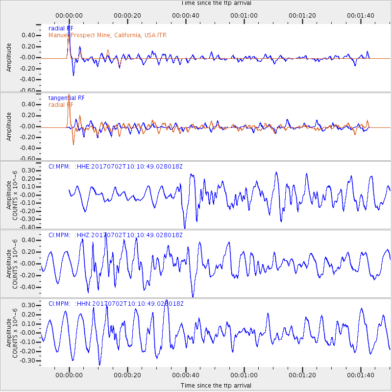
MPM Manuel Prospect Mine, California, USA - Earthquake Result Viewer
*The percent match for this event was below the threshold and hence no stack was calculated.
| Earthquake location: |
Kermadec Islands Region |
| Earthquake latitude/longitude: |
-27.4/-176.5 |
| Earthquake time(UTC): |
2017/07/02 (183) 09:58:50 GMT |
| Earthquake Depth: |
16 km |
| Earthquake Magnitude: |
5.7 Mww |
| Earthquake Catalog/Contributor: |
NEIC PDE/us |
|
| Network: |
CI Caltech Regional Seismic Network |
| Station: |
MPM Manuel Prospect Mine, California, USA |
| Lat/Lon: |
36.06 N/117.49 W |
| Elevation: |
185 m |
|
| Distance: |
84.0 deg |
| Az: |
44.271 deg |
| Baz: |
230.016 deg |
| Ray Param: |
$rayparam |
*The percent match for this event was below the threshold and hence was not used in the summary stack. |
|
| Radial Match: |
76.128975 % |
| Radial Bump: |
389 |
| Transverse Match: |
64.60661 % |
| Transverse Bump: |
385 |
| SOD ConfigId: |
13570011 |
| Insert Time: |
2019-04-28 07:53:39.494 +0000 |
| GWidth: |
2.5 |
| Max Bumps: |
400 |
| Tol: |
0.001 |
|
Signal To Noise
| Channel | StoN | STA | LTA |
| CI:MPM: :HHZ:20170702T10:10:49.028018Z | 2.731787 | 2.1247646E-7 | 7.777929E-8 |
| CI:MPM: :HHN:20170702T10:10:49.028018Z | 2.474946 | 1.8127541E-7 | 7.324418E-8 |
| CI:MPM: :HHE:20170702T10:10:49.028018Z | 1.1432846 | 7.612339E-8 | 6.658307E-8 |
| Arrivals |
| Ps | |
| PpPs | |
| PsPs/PpSs | |


