You are here: Home > Network List > TA - USArray Transportable Network (new EarthScope stations) Stations List
> Station J25K Salcha River, AK, USA > Earthquake Result Viewer
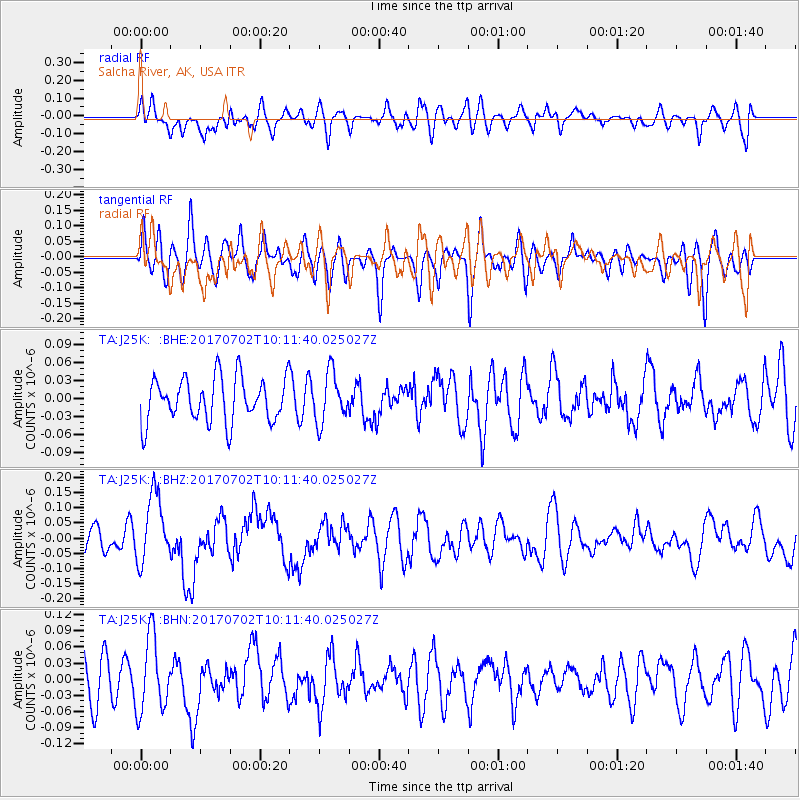
J25K Salcha River, AK, USA - Earthquake Result Viewer
*The percent match for this event was below the threshold and hence no stack was calculated.
| Earthquake location: |
Kermadec Islands Region |
| Earthquake latitude/longitude: |
-27.4/-176.5 |
| Earthquake time(UTC): |
2017/07/02 (183) 09:58:50 GMT |
| Earthquake Depth: |
16 km |
| Earthquake Magnitude: |
5.7 Mww |
| Earthquake Catalog/Contributor: |
NEIC PDE/us |
|
| Network: |
TA USArray Transportable Network (new EarthScope stations) |
| Station: |
J25K Salcha River, AK, USA |
| Lat/Lon: |
64.61 N/145.37 W |
| Elevation: |
949 m |
|
| Distance: |
94.8 deg |
| Az: |
12.905 deg |
| Baz: |
207.439 deg |
| Ray Param: |
$rayparam |
*The percent match for this event was below the threshold and hence was not used in the summary stack. |
|
| Radial Match: |
51.834183 % |
| Radial Bump: |
400 |
| Transverse Match: |
56.458004 % |
| Transverse Bump: |
400 |
| SOD ConfigId: |
13570011 |
| Insert Time: |
2019-04-28 07:56:52.077 +0000 |
| GWidth: |
2.5 |
| Max Bumps: |
400 |
| Tol: |
0.001 |
|
Signal To Noise
| Channel | StoN | STA | LTA |
| TA:J25K: :BHZ:20170702T10:11:40.025027Z | 2.5876102 | 1.1326907E-7 | 4.377362E-8 |
| TA:J25K: :BHN:20170702T10:11:40.025027Z | 1.93512 | 6.9159306E-8 | 3.5739028E-8 |
| TA:J25K: :BHE:20170702T10:11:40.025027Z | 1.1126828 | 4.0848324E-8 | 3.6711562E-8 |
| Arrivals |
| Ps | |
| PpPs | |
| PsPs/PpSs | |


