You are here: Home > Network List > G - GEOSCOPE Stations List
> Station CRZF Port Alfred, Crozet, South Indian Ocean > Earthquake Result Viewer
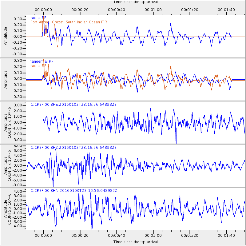
CRZF Port Alfred, Crozet, South Indian Ocean - Earthquake Result Viewer
*The percent match for this event was below the threshold and hence no stack was calculated.
| Earthquake location: |
Myanmar-India Border Region |
| Earthquake latitude/longitude: |
24.8/93.7 |
| Earthquake time(UTC): |
2016/01/03 (003) 23:05:22 GMT |
| Earthquake Depth: |
55 km |
| Earthquake Magnitude: |
6.7 MWW, 6.6 MWB |
| Earthquake Catalog/Contributor: |
NEIC PDE/NEIC COMCAT |
|
| Network: |
G GEOSCOPE |
| Station: |
CRZF Port Alfred, Crozet, South Indian Ocean |
| Lat/Lon: |
46.43 S/51.86 E |
| Elevation: |
140 m |
|
| Distance: |
80.4 deg |
| Az: |
207.874 deg |
| Baz: |
37.891 deg |
| Ray Param: |
$rayparam |
*The percent match for this event was below the threshold and hence was not used in the summary stack. |
|
| Radial Match: |
62.357235 % |
| Radial Bump: |
400 |
| Transverse Match: |
67.5066 % |
| Transverse Bump: |
400 |
| SOD ConfigId: |
1379111 |
| Insert Time: |
2016-01-17 23:12:28.659 +0000 |
| GWidth: |
2.5 |
| Max Bumps: |
400 |
| Tol: |
0.001 |
|
Signal To Noise
| Channel | StoN | STA | LTA |
| G:CRZF:00:BHZ:20160103T23:16:56.648982Z | 2.8195274 | 2.6152095E-6 | 9.275347E-7 |
| G:CRZF:00:BHN:20160103T23:16:56.648982Z | 1.5095513 | 1.2749309E-6 | 8.445761E-7 |
| G:CRZF:00:BHE:20160103T23:16:56.648982Z | 1.2608443 | 1.0433228E-6 | 8.274794E-7 |
| Arrivals |
| Ps | |
| PpPs | |
| PsPs/PpSs | |


