A05A Maple Falls, WA, USA - Earthquake Result Viewer
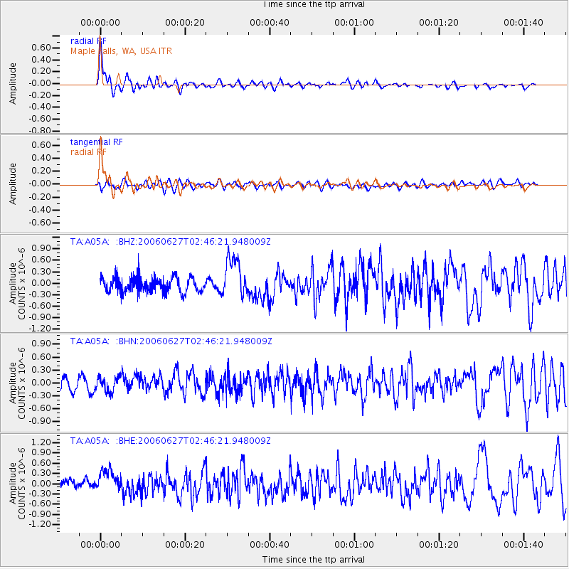
Earthquake location: Rat Islands, Aleutian Islands
Earthquake latitude/longitude: 52.2/176.2
Earthquake time(UTC): 2006/06/27 (178) 02:39:35 GMT
Earthquake Depth: 34 km
Earthquake Magnitude: 5.6 MB, 6.0 MS, 6.2 MW, 6.2 MW
Earthquake Catalog/Contributor: WHDF/NEIC
Network: TA USArray Transportable Network (new EarthScope stations)
Station: A05A Maple Falls, WA, USA
Lat/Lon: 49.00 N/122.09 W
Elevation: 174 m
Distance: 38.3 deg
Az: 69.467 deg
Baz: 298.947 deg
Ray Param: 0.07559207
Estimated Moho Depth: 16.25 km
Estimated Crust Vp/Vs: 1.75
Assumed Crust Vp: 6.566 km/s
Estimated Crust Vs: 3.741 km/s
Estimated Crust Poisson's Ratio: 0.26
Radial Match: 83.465805 %
Radial Bump: 400
Transverse Match: 62.154 %
Transverse Bump: 400
SOD ConfigId: 2665
Insert Time: 2010-03-06 01:34:14.547 +0000
GWidth: 2.5
Max Bumps: 400
Tol: 0.001

Signal To Noise

ChannelStoNSTALTA
TA:A05A: :BHN:20060627T02:46:21.948009Z1.32598041.7696964E-71.3346323E-7
TA:A05A: :BHE:20060627T02:46:21.948009Z2.2002093.8366028E-71.7437448E-7
TA:A05A: :BHZ:20060627T02:46:21.948009Z2.8346535.378641E-71.8974602E-7
Arrivals
Ps2.0 SECOND
PpPs6.3 SECOND
PsPs/PpSs8.3 SECOND